Approximate Location Map
Large Map »
Latitude: 51.0538 / 51°3'13"N
Longitude: 0.5316 / 0°31'53"E
OS Eastings: 577527
OS Northings: 131322
OS Grid: TQ775313
Mapcode National: GBR PTR.WRP
Mapcode Global: FRA D60B.DY2
Plus Code: 9F323G3J+GM
Entry Name: Bridge at TQ 775 313
Listing Date: 22 June 1989
Grade: II
Source: Historic England
Source ID: 1084577
English Heritage Legacy ID: 169811
ID on this website: 101084577
Location: Gun Green, Tunbridge Wells, Kent, TN18
County: Kent
District: Tunbridge Wells
Civil Parish: Hawkhurst
Traditional County: Kent
Lieutenancy Area (Ceremonial County): Kent
Tagged with: Bridge
HAWKHURST WATER LANE
TQ 73 SE
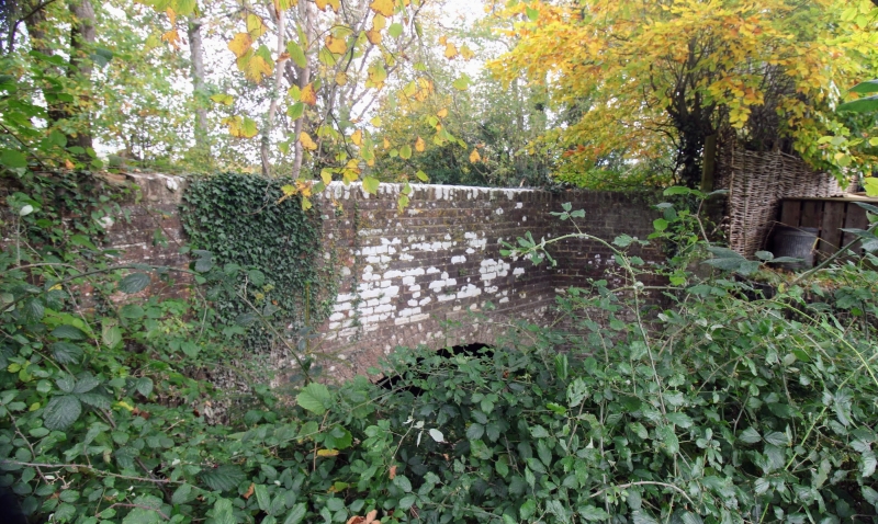
10/460 Bridge at TQ 775 313
GV II
Bridge. Dated 1834. Red brick. Single arched span over stream, with keystones
inscribed: TR to western,
1834
and inscribed: TT
1834 to eastern face. Parapet wall, part rebuilt, about 3 feet
above road level and canted at either end about 1 metre so as to form a retaining
wall to the stream bank on either face.
Listing NGR: TQ7752731322
External links are from the relevant listing authority and, where applicable, Wikidata. Wikidata IDs may be related buildings as well as this specific building. If you want to add or update a link, you will need to do so by editing the Wikidata entry.


Other nearby listed buildings
