Latitude: 51.047 / 51°2'49"N
Longitude: 0.5127 / 0°30'45"E
OS Eastings: 576229
OS Northings: 130516
OS Grid: TQ762305
Mapcode National: GBR PTX.BFP
Mapcode Global: FRA C6YC.5KP
Plus Code: 9F322GW7+Q3
Entry Name: Well and Housing in Churchyard Wall About 25 Metres North East of Church of All Saints
Listing Date: 22 June 1989
Grade: II
Source: Historic England
Source ID: 1084603
English Heritage Legacy ID: 169773
ID on this website: 101084603
Location: Highgate, Tunbridge Wells, Kent, TN18
County: Kent
District: Tunbridge Wells
Civil Parish: Hawkhurst
Built-Up Area: Hawkhurst
Traditional County: Kent
Lieutenancy Area (Ceremonial County): Kent
Tagged with: Well
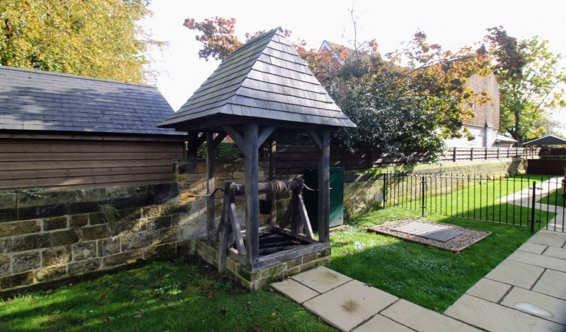
HAWKHURST RYE ROAD TO 7630-7730 (south side) Highgate 17/423 Well and housing in churchyard wall about 25 metres north-east of Church of All Saints GV II Well and housing. Circa 1861 by Sir G G Scott. Timber on standstone base with shingled roof. The outer frame supports a shingled pyramidal roof with terracotta finial which backs onto the churchyard wall. Within this shelter is a secondary braced frame with wooden housing for the wooden winding shaft, turned by iron handle to right. Below are the trap doors to the well shaft, with scrolled iron strap hinges.
Listing NGR: TQ7622930516
External links are from the relevant listing authority and, where applicable, Wikidata. Wikidata IDs may be related buildings as well as this specific building. If you want to add or update a link, you will need to do so by editing the Wikidata entry.


Other nearby listed buildings