Latitude: 51.0909 / 51°5'27"N
Longitude: 0.4266 / 0°25'35"E
OS Eastings: 570031
OS Northings: 135199
OS Grid: TQ700351
Mapcode National: GBR NRX.DPP
Mapcode Global: FRA C6S7.G24
Plus Code: 9F323CRG+9J
Entry Name: Lychgate and Walls About 25 Metres West of Christ Church
Listing Date: 22 June 1989
Grade: II
Source: Historic England
Source ID: 1084690
English Heritage Legacy ID: 169482
ID on this website: 101084690
Location: Christ Church, Kilndown, Tunbridge Wells, Kent, TN17
County: Kent
District: Tunbridge Wells
Civil Parish: Goudhurst
Traditional County: Kent
Lieutenancy Area (Ceremonial County): Kent
Tagged with: Lychgate
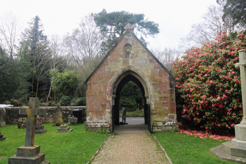
GOUDHURST CHURCH ROAD TQ 73 NW (east side) Kilndown 5/132 Lychgate and walls about 25 metres west of Christ Church GV II Lychgate and walls, 1860, probably by William Slater, architect. Sandstone with stone slate roof. Lychgate on weathered and moulded plinth, a small building rather than a mere gateway. One storey, gabled with central cross-finial and incised cross in gable, with arched and double chamfered entrance, the inner order on attached shafts. Two shouldered window openings to each side. Simple spear headed railed gates to western roadside entrance, cast and wrought gates to eastern entrance, with scrolled plant forms with leaf-terminals. Interior: side benches with marble/granite colonettes to window surrounds, and vaulted roof with diaphragm arch on columns. Stone walls extending along roadside either side of lychgate, about 5 feet high, extending some 25 yards to south and 40 yards to north to the adjacent school (item 5/132).
Listing NGR: TQ7003135199
External links are from the relevant listing authority and, where applicable, Wikidata. Wikidata IDs may be related buildings as well as this specific building. If you want to add or update a link, you will need to do so by editing the Wikidata entry.


Other nearby listed buildings