Approximate Location Map
Large Map »
Latitude: 51.3434 / 51°20'36"N
Longitude: 1.09 / 1°5'24"E
OS Eastings: 615300
OS Northings: 165015
OS Grid: TR153650
Mapcode National: GBR TXB.LDT
Mapcode Global: VHLG7.VH3H
Plus Code: 9F3383VR+92
Entry Name: Tinkers Thatch
Listing Date: 14 May 1976
Grade: II
Source: Historic England
Source ID: 1084950
English Heritage Legacy ID: 170761
ID on this website: 101084950
Location: West End, Canterbury, Kent, CT6
County: Kent
District: Canterbury
Electoral Ward/Division: Greenhill
Parish: Non Civil Parish
Traditional County: Kent
Lieutenancy Area (Ceremonial County): Kent
Tagged with: Building Thatched cottage
1.
5273 THORNDEN WOOD ROAD
(East Side)
Herne Bay
------------
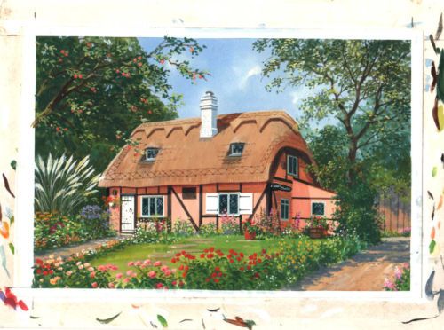
Tinkers Thatch
TR 16 NE 6/177
II
2.
Cl7 2 storeys timber-framed with diagonal braces. Painted brick infill. Half-
hipped thatched roof with 1 dormer. 2 diamond paned casements. Simple batten
doors. Shutters to right hand window. 1 storey thatched extension to left side.
Listing NGR: TR1530065015
External links are from the relevant listing authority and, where applicable, Wikidata. Wikidata IDs may be related buildings as well as this specific building. If you want to add or update a link, you will need to do so by editing the Wikidata entry.


Other nearby listed buildings
