Approximate Location Map
Large Map »
Latitude: 51.3554 / 51°21'19"N
Longitude: 1.1369 / 1°8'12"E
OS Eastings: 618510
OS Northings: 166486
OS Grid: TR185664
Mapcode National: GBR TX6.SCC
Mapcode Global: VHLG8.N6F8
Plus Code: 9F33944P+5Q
Entry Name: Herne Windmill
Listing Date: 29 September 1951
Grade: I
Source: Historic England
Source ID: 1084984
English Heritage Legacy ID: 170736
ID on this website: 101084984
Location: Hunters Forstal, Canterbury, Kent, CT6
County: Kent
District: Canterbury
Civil Parish: Herne and Broomfield
Built-Up Area: Herne Bay
Traditional County: Kent
Lieutenancy Area (Ceremonial County): Kent
Tagged with: Windmill
1.
5273 MILL LANE
(North West Side)
Herne
-----------------
Herne Windmill
TR 16 NE 6/53 29.9.51.
I GV
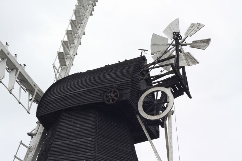
2.
Smock type built in 1781. Tarred brick octagonal round-house with platform round
minus its handrail. Above tarred weatherboarding. Hooded cap. Fantail intact.
Sails missing.
Herne Windmill and No 88 form a group.
Listing NGR: TR1851066486
External links are from the relevant listing authority and, where applicable, Wikidata. Wikidata IDs may be related buildings as well as this specific building. If you want to add or update a link, you will need to do so by editing the Wikidata entry.


Other nearby listed buildings
