Latitude: 51.3715 / 51°22'17"N
Longitude: 1.1179 / 1°7'4"E
OS Eastings: 617110
OS Northings: 168214
OS Grid: TR171682
Mapcode National: GBR TWZ.TQY
Mapcode Global: VHLG2.BSCJ
Plus Code: 9F3394C9+H5
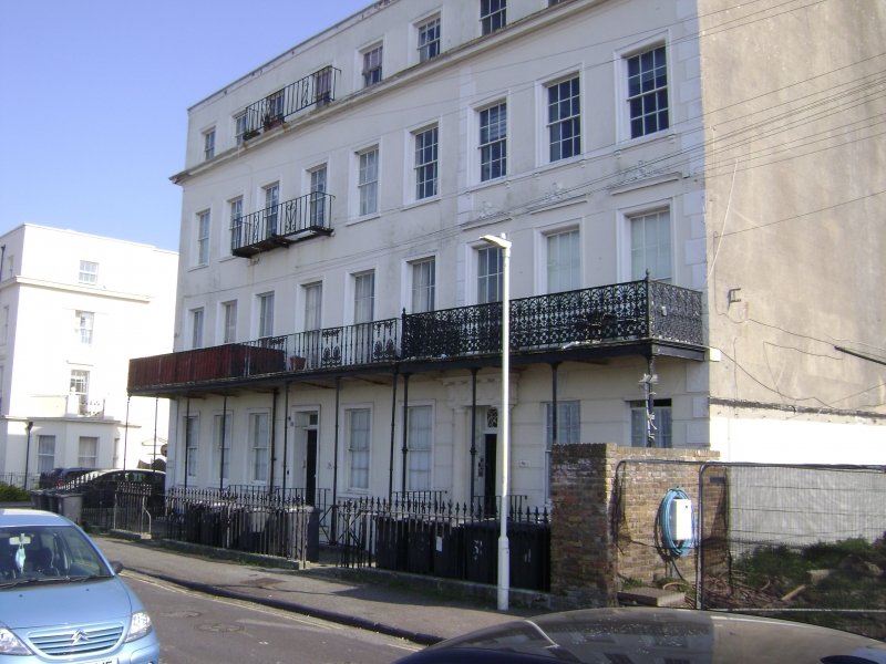
Entry Name: 18-20, St GEORGES TERRACE (See details for further address information)
Listing Date: 14 May 1976
Grade: II
Source: Historic England
Source ID: 1084989
English Heritage Legacy ID: 170748
ID on this website: 101084989
Location: Herne Bay, Canterbury, Kent, CT6
County: Kent
District: Canterbury
Electoral Ward/Division: Heron
Parish: Non Civil Parish
Built-Up Area: Herne Bay
Traditional County: Kent
Lieutenancy Area (Ceremonial County): Kent
Tagged with: Building
1. 5273 ST GEORGES TERRACE Herne Bay ----------------- Nos 1 to 15 (consec) and Nos 18 to 20 (consec) TR 1768 SW 2/14
II GV
2. A terrace circa 1830. 4 storeys and basement with area stuccoed. Cornice and parapet above 3rd and 2nd floors. 3 windows to each house except No 7 which has 6 windows and No 15, 9 windows. Iron balconies on 1st floor. Nos 7 and 11 with hoods. Most glazing bars intact, Nos 1, 2 and 3, 8 to 11, 15 and 18, 19 and 20 have their windows above the ground floor in moulded architrave surrounds, with cornices over in the case of those on the 1st floor. Doorcases in moulded architrave surrounds with rectangular fanlights, Nos 1-6, 9 and l0 also with pilasters and projecting cornices over beneath the balconies. Nos 2, 7 and 15 also have porches with Doric columns. No 15 has 1 storey less than the others. No 18 has a porch with Doric pilasters.
Nos 1 to 15 (consec) form a group with Nos 19 to 21 (consec).
Listing NGR: TR1711068214
External links are from the relevant listing authority and, where applicable, Wikidata. Wikidata IDs may be related buildings as well as this specific building. If you want to add or update a link, you will need to do so by editing the Wikidata entry.


Other nearby listed buildings