Latitude: 51.2801 / 51°16'48"N
Longitude: 1.0835 / 1°5'0"E
OS Eastings: 615141
OS Northings: 157952
OS Grid: TR151579
Mapcode National: GBR TY2.QQH
Mapcode Global: VHLGM.Q3N1
Plus Code: 9F3373JM+29
Entry Name: Prior's Chapel
Listing Date: 7 September 1973
Grade: I
Source: Historic England
Source ID: 1085065
English Heritage Legacy ID: 170534
ID on this website: 101085065
Location: Christ Church Cathedral, Canterbury, Kent, CT1
County: Kent
District: Canterbury
Electoral Ward/Division: Westgate
Parish: Non Civil Parish
Built-Up Area: Canterbury
Traditional County: Kent
Lieutenancy Area (Ceremonial County): Kent
Tagged with: Chapel
1.
944 THE CATHEDRAL PRECINCTS
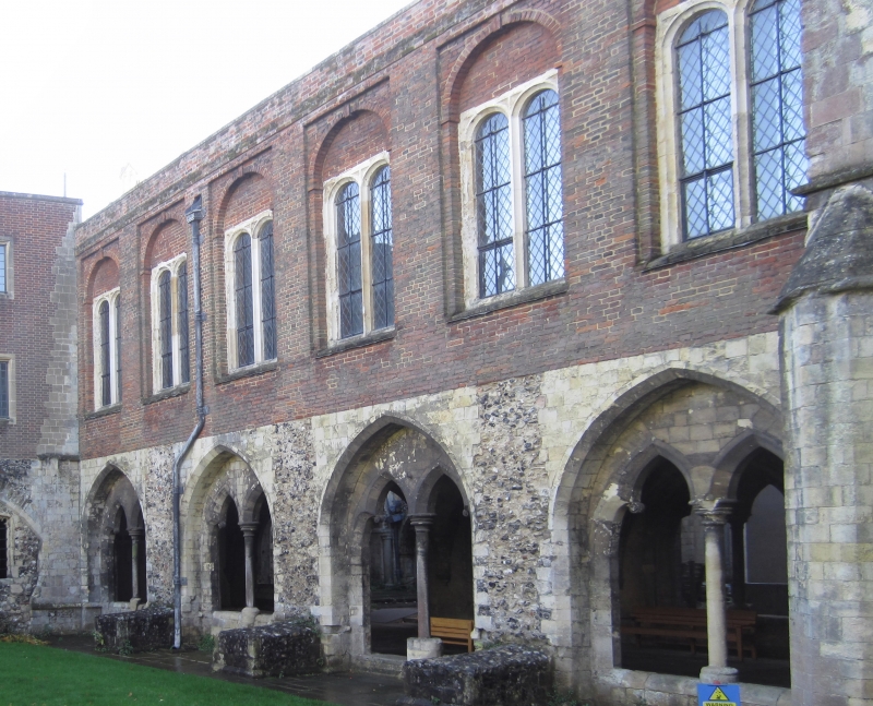
Prior's Chapel
TR 1557 NW 5/1F
I
2.
Cl260. Only the open undercroft remains incorporated in the brick library
(the Hawley garrison Library) of 1660.
Listing NGR: TR1513957952
External links are from the relevant listing authority and, where applicable, Wikidata. Wikidata IDs may be related buildings as well as this specific building. If you want to add or update a link, you will need to do so by editing the Wikidata entry.


Other nearby listed buildings