Approximate Location Map
Large Map »
Latitude: 51.2768 / 51°16'36"N
Longitude: 1.0769 / 1°4'36"E
OS Eastings: 614699
OS Northings: 157570
OS Grid: TR146575
Mapcode National: GBR TY2.WLP
Mapcode Global: VHLGM.M55J
Plus Code: 9F3373GG+PQ
Entry Name: 16-18, Castle Street
Listing Date: 3 May 1967
Grade: II
Source: Historic England
Source ID: 1085093
English Heritage Legacy ID: 170497
ID on this website: 101085093
Location: Canterbury, Kent, CT1
County: Kent
District: Canterbury
Electoral Ward/Division: Westgate
Parish: Non Civil Parish
Built-Up Area: Canterbury
Traditional County: Kent
Lieutenancy Area (Ceremonial County): Kent
Tagged with: Building
1.
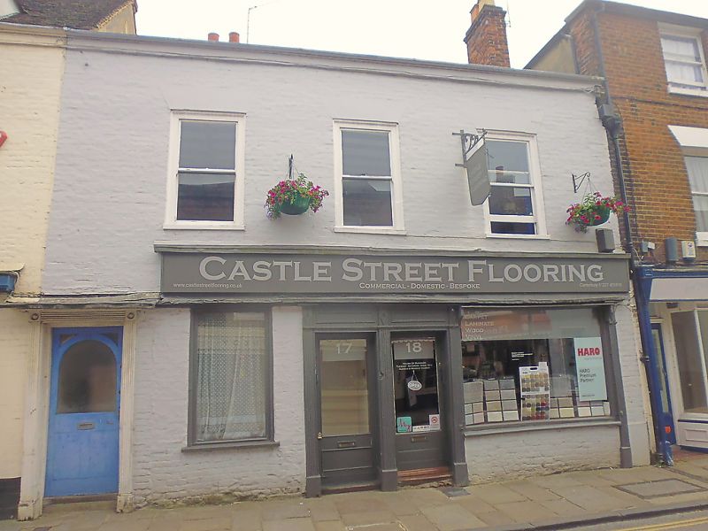
944 CASTLE STREET
(South East Side)
Nos 16 to 18 (consec)
TR 1457 NE 4/259 3.5.67.
II GV
2.
Early C19. 2 storeys painted brick. 3 C19 sashes. Double doorcase with
moulded architraves to Nos 17 and 18. No 16 has an early C19 doorcase with
reeded pilasters.
Nos 1 to 9 (consec) and Nos 12 to 24 (consec) form a group.
Listing NGR: TR1471057576
External links are from the relevant listing authority and, where applicable, Wikidata. Wikidata IDs may be related buildings as well as this specific building. If you want to add or update a link, you will need to do so by editing the Wikidata entry.


Other nearby listed buildings
