Approximate Location Map
Large Map »
Latitude: 51.2771 / 51°16'37"N
Longitude: 1.077 / 1°4'37"E
OS Eastings: 614704
OS Northings: 157601
OS Grid: TR147576
Mapcode National: GBR TY2.WMW
Mapcode Global: VHLGM.M57B
Plus Code: 9F3373GG+RR
Entry Name: 68 and 68A, Castle Street
Listing Date: 3 May 1967
Grade: II*
Source: Historic England
Source ID: 1085101
English Heritage Legacy ID: 170519
ID on this website: 101085101
Location: Canterbury, Kent, CT1
County: Kent
District: Canterbury
Electoral Ward/Division: Westgate
Parish: Non Civil Parish
Built-Up Area: Canterbury
Traditional County: Kent
Lieutenancy Area (Ceremonial County): Kent
Tagged with: Building
1.
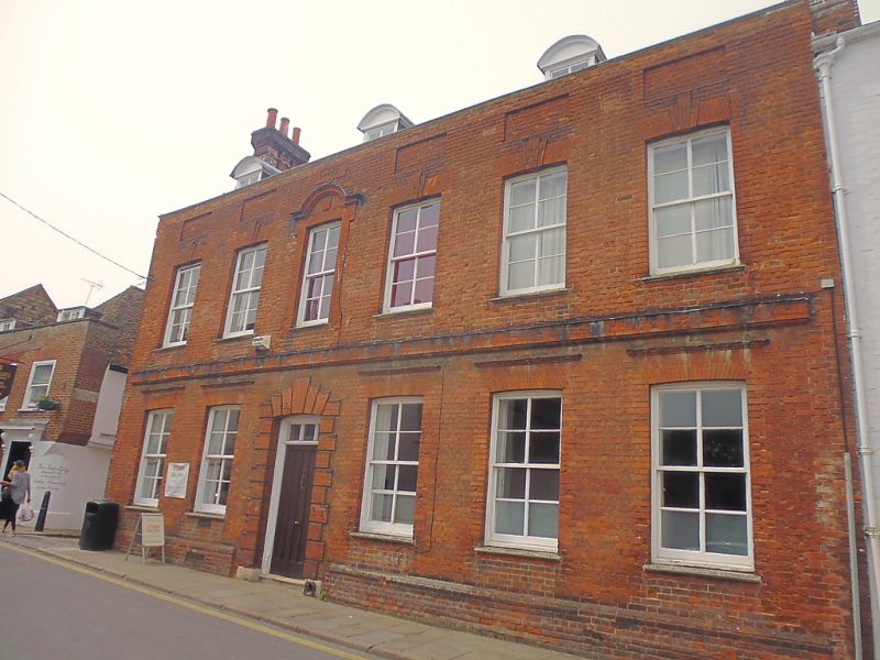
944 CASTLE STREET
(North West Side)
Nos 68 and 68a
TR 1457 NE 4/264 3.5.67.
II* GV
2.
Dated 1847, but this can only refer to the buildings refacing. Early C18.
2 storeys, basement and attics red brick. Old tiled roof with 2 end stacks
and curved gable on left side. 2 curved dormers. Panelled parapet. 6 sashes
with keystones on lst floor. Central, lst floor window has a brick surround
and curved gable. Stringcourse. Plinth. Doorcase has a keystone and quoins
and rectangular fanlight. The interior has spiral turned balustor, 2 to
each tread on cut string with shaped brackets, swept rail and column newels.
Early C19 mantelpieces.
Nos 68 to 77 (consec) and Nos 80 to 82 (consec) form a group.
Listing NGR: TR1470457607
External links are from the relevant listing authority and, where applicable, Wikidata. Wikidata IDs may be related buildings as well as this specific building. If you want to add or update a link, you will need to do so by editing the Wikidata entry.


Other nearby listed buildings
