Approximate Location Map
Large Map »
Latitude: 51.2791 / 51°16'44"N
Longitude: 1.0818 / 1°4'54"E
OS Eastings: 615028
OS Northings: 157838
OS Grid: TR150578
Mapcode National: GBR TY2.QBS
Mapcode Global: VHLGM.P3RS
Plus Code: 9F3373HJ+JP
Entry Name: 29 and 30, Burgate
Listing Date: 3 May 1967
Grade: II
Source: Historic England
Source ID: 1085116
English Heritage Legacy ID: 170452
ID on this website: 101085116
Location: Canterbury, Kent, CT1
County: Kent
District: Canterbury
Electoral Ward/Division: Westgate
Parish: Non Civil Parish
Built-Up Area: Canterbury
Traditional County: Kent
Lieutenancy Area (Ceremonial County): Kent
Tagged with: Building
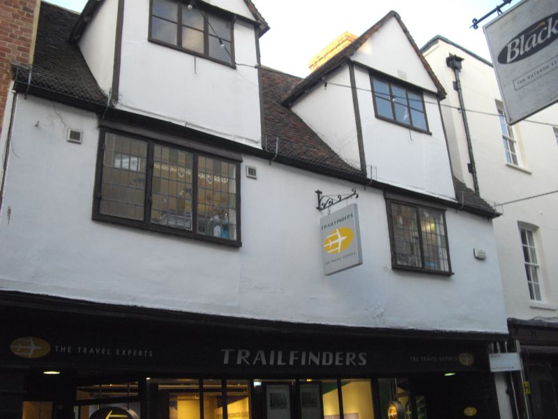
1.
944 BURGATE
(North East Side)
Nos 29 and 30
TR 1557 NW 5/20 3.5.67.
II GV
2.
C16. 2 storeys and attics plastered. Old toed roof with 2 hipped dormers.
2 restored casements. Modern shopfront.
Nos 23 to 37 (consec) and the Christchurch Gateway form a group.
Listing NGR: TR1503057840
External links are from the relevant listing authority and, where applicable, Wikidata. Wikidata IDs may be related buildings as well as this specific building. If you want to add or update a link, you will need to do so by editing the Wikidata entry.


Other nearby listed buildings
