Latitude: 51.0171 / 51°1'1"N
Longitude: 0.5513 / 0°33'4"E
OS Eastings: 579049
OS Northings: 127289
OS Grid: TQ790272
Mapcode National: GBR PVC.27H
Mapcode Global: FRA D61F.8MM
Plus Code: 9F322H82+RG
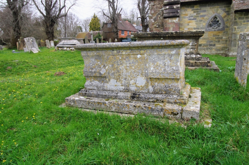
Entry Name: Monument Approximately 1 Metre South Monument to Mary Collins at St Nicholas Church
Listing Date: 5 July 1993
Grade: II
Source: Historic England
Source ID: 1085173
English Heritage Legacy ID: 170289
ID on this website: 101085173
Location: St Nicholas's Church, Sandhurst Cross, Tunbridge Wells, Kent, TN18
County: Kent
District: Tunbridge Wells
Civil Parish: Sandhurst
Traditional County: Kent
Lieutenancy Area (Ceremonial County): Kent
Tagged with: Building
SANDHURST TQ72NE CHURCH ROAD 1350-0/5/181 Monument approx 1 metre south Monument to Mary Collins at St Nicholas Church GV II Chest tomb. Mid C18 type but inscription illegible. Stone with moulded base on 2 steps. Corner balusters and raised inscription panels.
Listing NGR: TQ7905427314
External links are from the relevant listing authority and, where applicable, Wikidata. Wikidata IDs may be related buildings as well as this specific building. If you want to add or update a link, you will need to do so by editing the Wikidata entry.


Other nearby listed buildings