Latitude: 51.0602 / 51°3'36"N
Longitude: 0.5756 / 0°34'32"E
OS Eastings: 580580
OS Northings: 132145
OS Grid: TQ805321
Mapcode National: GBR PTT.GB8
Mapcode Global: FRA D639.S3Q
Plus Code: 9F323H6G+36
Entry Name: Barn at Frame Farm Approximately 30 Metres North East of Farmhouse
Listing Date: 5 July 1993
Grade: II
Source: Historic England
Source ID: 1085245
English Heritage Legacy ID: 170159
ID on this website: 101085245
Location: Iden Green, Tunbridge Wells, Kent, TN17
County: Kent
District: Tunbridge Wells
Civil Parish: Benenden
Traditional County: Kent
Lieutenancy Area (Ceremonial County): Kent
Tagged with: Barn
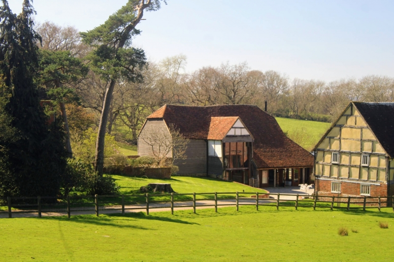
BENENDEN TQ8032 IDEN GREEN 1350-0/7/52 Barn at Frame Farm approx 30 metres north east of Farmhouse II Barn. C18. Timber-framed, clad in weatherboarding on brick plinth. Half-hipped plain tiled roof. 5 bays. Queen post construction with collar beam. Staggered purlins with some added diagonal beams. Jowled posts and diagonal tension braces to wall frame. Central gabled cart entrance. Lean-to to north east, mostly modern on 3 square posts.
Listing NGR: TQ8058032145
External links are from the relevant listing authority and, where applicable, Wikidata. Wikidata IDs may be related buildings as well as this specific building. If you want to add or update a link, you will need to do so by editing the Wikidata entry.


Other nearby listed buildings