Latitude: 51.0915 / 51°5'29"N
Longitude: 0.411 / 0°24'39"E
OS Eastings: 568939
OS Northings: 135233
OS Grid: TQ689352
Mapcode National: GBR NRW.GRN
Mapcode Global: FRA C6R7.FZD
Plus Code: 9F323CR6+JC
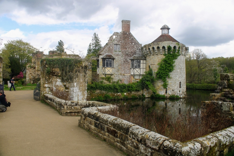
Entry Name: Causeway and Walls About 20 Metres West of Old Scotney Castle
Listing Date: 10 October 1989
Grade: II
Source: Historic England
Source ID: 1085288
English Heritage Legacy ID: 170063
ID on this website: 101085288
Location: Kilndown, Tunbridge Wells, Kent, TN3
County: Kent
District: Tunbridge Wells
Civil Parish: Lamberhurst
Traditional County: Sussex
Lieutenancy Area (Ceremonial County): Kent
Church of England Parish: Lamberhurst St Mary
Church of England Diocese: Rochester
Tagged with: Building
LAMBERHURST SCOTNEY TQ 63 NE 3/226 Causeway and walls about 20 metres west of Old Scotney Castle GV II
Causeway and walls. C14 origin, reconstructed c.1840. Sandstone. The causeway is to the outer of the two islands in the River Teise on which the Castle was built. The side walls are mine 3 feet in height, about 10 metres in length, and continue an the west side about another 10 metres; also returned along the inner bank of the moat to the west forming an embankment wall, and terminating in ruinous gate piers about 20 metres from the causeway.
Listing NGR: TQ6893935232
External links are from the relevant listing authority and, where applicable, Wikidata. Wikidata IDs may be related buildings as well as this specific building. If you want to add or update a link, you will need to do so by editing the Wikidata entry.


Other nearby listed buildings