Latitude: 51.3382 / 51°20'17"N
Longitude: 1.4236 / 1°25'24"E
OS Eastings: 638554
OS Northings: 165461
OS Grid: TR385654
Mapcode National: GBR X0M.0R8
Mapcode Global: VHMCW.MMGJ
Plus Code: 9F338CQF+7C
Entry Name: Nos 23, 25, 27 and 29 with Railed Areas
Listing Date: 4 February 1988
Grade: II
Source: Historic England
Source ID: 1085390
English Heritage Legacy ID: 171799
ID on this website: 101085390
Location: Ramsgate, Thanet, Kent, CT11
County: Kent
District: Thanet
Civil Parish: Ramsgate
Built-Up Area: Ramsgate
Traditional County: Kent
Lieutenancy Area (Ceremonial County): Kent
Tagged with: Building
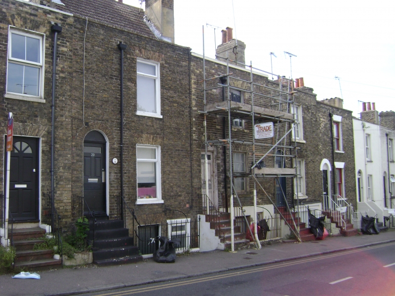
RAMSGATE HERESON ROAD TR 3865 SE (south-east side) 10/170 Nos. 23, 25, 27 and 29 with railed Areas GV II Terrace row. 1830's. Stock brick with slate and interlocking tiled roofs. Two storeys and basement, with 1 glazing bar sash to each floor of each house (including basement). Reeded and panelled doors with flights of 5 steps. Simple rails, ramped to steps and with dog rails to basement areas. Number 23 with late C20 replacement windows, No. 25 with metal casements, and large paned late C19 shop front to basement, with pilasters, fascia and cornice and glazed door. Number 29 with unusually high steeply pitched double span roof and stacks left and right.
Listing NGR: TR3855465461
External links are from the relevant listing authority and, where applicable, Wikidata. Wikidata IDs may be related buildings as well as this specific building. If you want to add or update a link, you will need to do so by editing the Wikidata entry.


Other nearby listed buildings