Latitude: 51.3005 / 51°18'1"N
Longitude: 1.1802 / 1°10'48"E
OS Eastings: 621789
OS Northings: 160512
OS Grid: TR217605
Mapcode National: GBR VZB.K5K
Mapcode Global: VHLGH.DKTW
Plus Code: 9F33852J+63
Entry Name: Poplar Farm Barn
Listing Date: 14 March 1980
Grade: II
Source: Historic England
Source ID: 1085458
English Heritage Legacy ID: 171568
ID on this website: 101085458
Location: Stodmarsh, Canterbury, Kent, CT3
County: Kent
District: Canterbury
Civil Parish: Wickhambreaux
Traditional County: Kent
Lieutenancy Area (Ceremonial County): Kent
Tagged with: Building
1. 5273 WICKHAMBREAUX STODMARSH ROAD (north-west side) Stodmarsh
Poplar Farm Barn TR 26 SW 9/692A
II GV
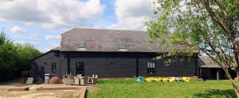
2. C18. One storey weatherboarded on red brick base. Half-hipped slate roof. Open sided cow shed extends to right.
Listing NGR: TR2178960512
External links are from the relevant listing authority and, where applicable, Wikidata. Wikidata IDs may be related buildings as well as this specific building. If you want to add or update a link, you will need to do so by editing the Wikidata entry.


Other nearby listed buildings