Latitude: 51.3116 / 51°18'41"N
Longitude: 1.1094 / 1°6'33"E
OS Eastings: 616798
OS Northings: 161537
OS Grid: TR167615
Mapcode National: GBR TXQ.R9G
Mapcode Global: VHLGG.59VC
Plus Code: 9F338465+MQ
Entry Name: Former Royal Oak Public House
Listing Date: 16 December 1975
Grade: II
Source: Historic England
Source ID: 1085502
English Heritage Legacy ID: 171468
Also known as: The Royal Oak, Canterbury
Royal Oak
ID on this website: 101085502
Location: Broad Oak, Canterbury, Kent, CT2
County: Kent
District: Canterbury
Civil Parish: Sturry
Built-Up Area: Broad Oak (Canterbury)
Traditional County: Kent
Lieutenancy Area (Ceremonial County): Kent
Tagged with: Pub
This list entry was subject to a Minor Amendment on 24 April 2025 to update the Name and Address and reformat the text to current standards
TR 16 SE
4/600
STURRY
ORCHARD VIEW
Oak House
(Formerly listed as SWEECHGATE Royal Oak Public House)
16.12.75
II
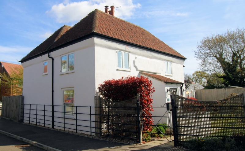
Outwardly C18 with late Mediaeval core. Two parallel ranges. Front elevation rendered. Other elevations painted brick. Hipped tiled roof. Two windows. Casements to first floor and sashes with verticals only to ground floor. Later porch.
The interior contains an exposed dragon beam.
Listing NGR: TR1679861537
External links are from the relevant listing authority and, where applicable, Wikidata. Wikidata IDs may be related buildings as well as this specific building. If you want to add or update a link, you will need to do so by editing the Wikidata entry.


Other nearby listed buildings