Latitude: 51.1957 / 51°11'44"N
Longitude: 1.0998 / 1°5'59"E
OS Eastings: 616674
OS Northings: 148625
OS Grid: TR166486
Mapcode National: GBR TZ2.WCD
Mapcode Global: VHLH1.06SP
Plus Code: 9F3353WX+7W
Entry Name: Clambercrown
Listing Date: 14 March 1980
Grade: II
Source: Historic England
Source ID: 1085589
English Heritage Legacy ID: 171266
ID on this website: 101085589
Location: Palmstead, Canterbury, Kent, CT4
County: Kent
District: Canterbury
Civil Parish: Upper Hardres
Traditional County: Kent
Lieutenancy Area (Ceremonial County): Kent
Tagged with: Building
1. 5273 KINGSTON QUITTERS WOOD Clambercrown TR 14 NE 17/365
II
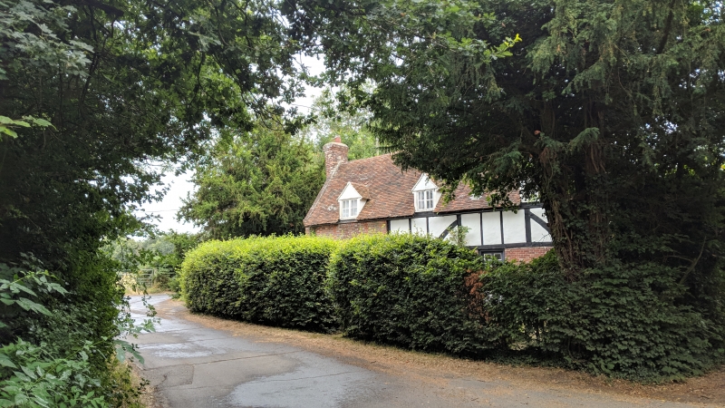
2. One storey and attics, 2 cottages. C17 or before. Timber-framed building with plaster infilling, the ground floor rebuilt in red and blue brick. Tile roof. The south-west window bay wholly refaced with red brick and blue headers, probably added C18. Three gabled dormers. Three windows, casements, one to the west of 3 lights below band. Two stacks, one external. Plain doors.
Listing NGR: TR1897950688
External links are from the relevant listing authority and, where applicable, Wikidata. Wikidata IDs may be related buildings as well as this specific building. If you want to add or update a link, you will need to do so by editing the Wikidata entry.


Other nearby listed buildings