Latitude: 51.2468 / 51°14'48"N
Longitude: 1.1247 / 1°7'28"E
OS Eastings: 618172
OS Northings: 154379
OS Grid: TR181543
Mapcode National: GBR TYJ.P5F
Mapcode Global: VHLGN.FXYK
Plus Code: 9F3364WF+PV
Entry Name: 33, High Street
Listing Date: 14 March 1980
Grade: II
Source: Historic England
Source ID: 1085704
English Heritage Legacy ID: 171032
ID on this website: 101085704
Location: Bridge, Canterbury, Kent, CT4
County: Kent
District: Canterbury
Civil Parish: Bridge
Built-Up Area: Bridge
Traditional County: Kent
Lieutenancy Area (Ceremonial County): Kent
Tagged with: Building
This list entry was subject to a Minor Amendment on 6 October 2025 to update the Name and Address and reformat the text to current standards
TR 1854
19/190
BRIDGE
HIGH STREET (north-east side)
No 33
(Formerly listed as No 33 (Bartters))
GV
II
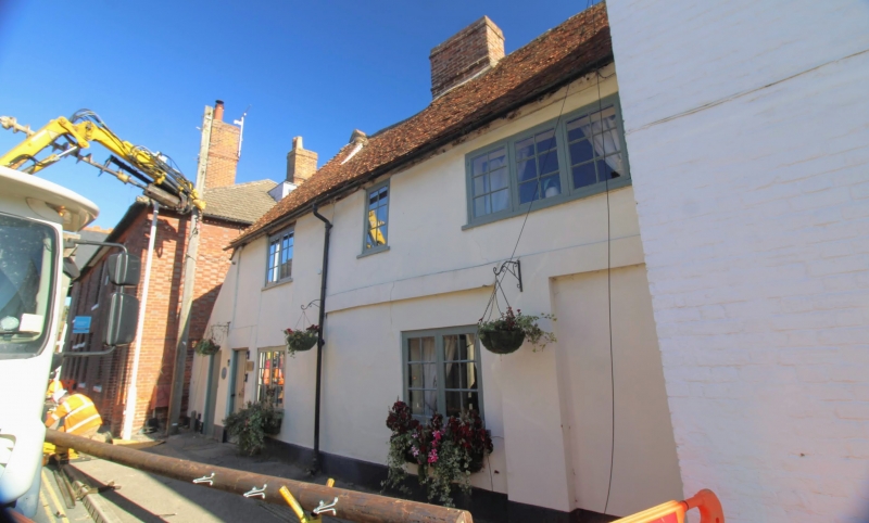
Including former No 35. C16 or earlier. Two storeys, rendered with tiled roof. Three windows, irregular, with modern casements of 2-1-3 lights. Two windows of two lights to ground floor and plain door, renamed lintel. Pilaster marks former doorway. Rendered cornice to right-hand portion.
Listing NGR: TR1817254379
External links are from the relevant listing authority and, where applicable, Wikidata. Wikidata IDs may be related buildings as well as this specific building. If you want to add or update a link, you will need to do so by editing the Wikidata entry.


Other nearby listed buildings