Approximate Location Map
Large Map »
Latitude: 51.4461 / 51°26'46"N
Longitude: 0.4904 / 0°29'25"E
OS Eastings: 573159
OS Northings: 174847
OS Grid: TQ731748
Mapcode National: GBR PP1.BSL
Mapcode Global: VHJLF.GX38
Plus Code: 9F32CFWR+F5
Entry Name: Granary at Buckland Farm
Listing Date: 14 November 1986
Grade: II
Source: Historic England
Source ID: 1085763
English Heritage Legacy ID: 172837
ID on this website: 101085763
Location: Medway, Kent, ME3
County: Medway
Civil Parish: Cliffe and Cliffe Woods
Traditional County: Kent
Lieutenancy Area (Ceremonial County): Kent
Church of England Parish: Cliffe-at-Hoo St Helen
Church of England Diocese: Rochester
Tagged with: Granary
CLIFFE-AT-HOO CP BUCKLAND ROAD
TQ 77 SW
5/19 West side
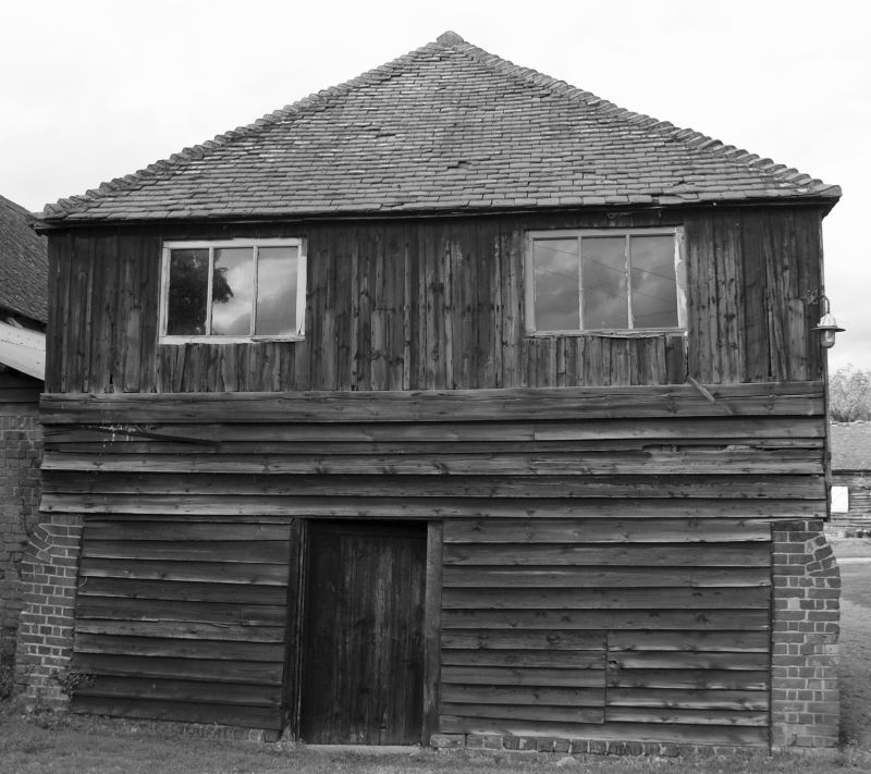
Granary at Buckland Farm
GV II
Granary. C17. Timberframed on brick plinth and weatherboarded with
hipped plain tiled roof. Square in plan.
Listing NGR: TQ7318174967
External links are from the relevant listing authority and, where applicable, Wikidata. Wikidata IDs may be related buildings as well as this specific building. If you want to add or update a link, you will need to do so by editing the Wikidata entry.


Other nearby listed buildings
