Latitude: 51.4527 / 51°27'9"N
Longitude: 0.2794 / 0°16'45"E
OS Eastings: 558471
OS Northings: 175102
OS Grid: TQ584751
Mapcode National: GBR X5.93D
Mapcode Global: VHHNV.SRK6
Plus Code: 9F32F73H+3P
Entry Name: The Woodlands
Listing Date: 5 May 1952
Grade: II
Source: Historic England
Source ID: 1085783
English Heritage Legacy ID: 172731
ID on this website: 101085783
Location: Swanscombe, Dartford, Kent, DA9
County: Kent
District: Dartford
Civil Parish: Swanscombe and Greenhithe
Built-Up Area: Swanscombe
Traditional County: Kent
Lieutenancy Area (Ceremonial County): Kent
Church of England Parish: Greenhithe St Mary
Church of England Diocese: Rochester
Tagged with: Building
1.
5274
TQ 57 NE
1/94
5.5.52
12.8.70
SWANSCOMBE AND GREENHITHE
HIGH STREET
(south side)
Greenhithe
No 79 (The Woodlands)
II
2.
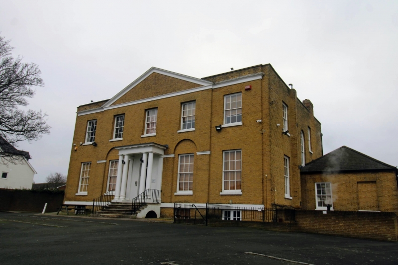
Formerly Nos 79 and 81. Circa 1800. Two storeys and semi-basement brown brick.
Hipped slate roof. Cornice and parapet. Five windows in all. The 3 centre window
bays project with a pediment over. Glazing bars intact. The 2 centre ground
floor windows are set in round-headed arcading. Porch between them with twin
Doric columns, decorated fanlight, panelled reveals and 5 panelled door placed
at the head of 6 steps with cast iron handrail.
Listing NGR: TQ5847175102
External links are from the relevant listing authority and, where applicable, Wikidata. Wikidata IDs may be related buildings as well as this specific building. If you want to add or update a link, you will need to do so by editing the Wikidata entry.


Other nearby listed buildings