Approximate Location Map
Large Map »
Latitude: 51.2768 / 51°16'36"N
Longitude: 0.1131 / 0°6'47"E
OS Eastings: 547487
OS Northings: 155193
OS Grid: TQ474551
Mapcode National: GBR LLH.Z9N
Mapcode Global: VHHPQ.X55J
Plus Code: 9F3274G7+P7
Entry Name: North Boundary Wall to Grounds of Brasted Place
Listing Date: 16 January 1975
Grade: II
Source: Historic England
Source ID: 1085834
English Heritage Legacy ID: 356915
ID on this website: 101085834
Location: Brasted, Sevenoaks, Kent, TN16
County: Kent
District: Sevenoaks
Civil Parish: Brasted
Built-Up Area: Brasted
Traditional County: Kent
Lieutenancy Area (Ceremonial County): Kent
Church of England Parish: Brasted St Martin
Church of England Diocese: Rochester
Tagged with: Wall
1.
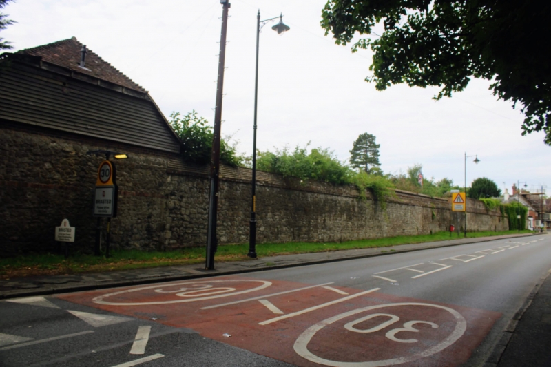
5802 BRASTED BRASTED
High Street
(south Side)
North Boundary Wall to
grounds of Brasted Place
TQ 4755 2/50
II
2.
Cl8 wall of random rubble masonry.
Listing NGR: TQ4748755193
External links are from the relevant listing authority and, where applicable, Wikidata. Wikidata IDs may be related buildings as well as this specific building. If you want to add or update a link, you will need to do so by editing the Wikidata entry.


Other nearby listed buildings
