Approximate Location Map
Large Map »
Latitude: 51.2684 / 51°16'6"N
Longitude: 0.1938 / 0°11'37"E
OS Eastings: 553142
OS Northings: 154419
OS Grid: TQ531544
Mapcode National: GBR MN4.FTD
Mapcode Global: VHHPS.9DT1
Plus Code: 9F32759V+8G
Entry Name: 29, High Street
Listing Date: 13 April 1951
Grade: II
Source: Historic England
Source ID: 1085981
English Heritage Legacy ID: 172214
ID on this website: 101085981
Location: Sevenoaks, Kent, TN13
County: Kent
District: Sevenoaks
Civil Parish: Sevenoaks
Built-Up Area: Sevenoaks
Traditional County: Kent
Lieutenancy Area (Ceremonial County): Kent
Church of England Parish: Sevenoaks St Nicholas
Church of England Diocese: Rochester
Tagged with: Building
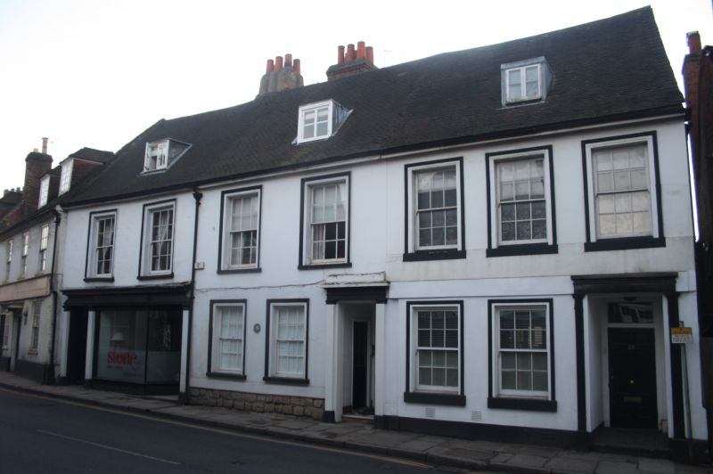
HIGH STREET
1.
161+
(West Side)
No 29
TO 5354/1/36 13.4.51
II GV
2.
With Nos 25 and 27.
Early C19 terrace. 2 storeys. Stucco. Eaves and gutter. Continuous
ridge roof.
3 closely spaced sash windows on first floor with moulded stucco surrounds.
Shop front on ground floor. Ridge Welsh slate roof with one small flat-
roofed leaded dormer.
Nos 19 to 37 (odd) form a group.
Listing NGR: TQ5314254419
External links are from the relevant listing authority and, where applicable, Wikidata. Wikidata IDs may be related buildings as well as this specific building. If you want to add or update a link, you will need to do so by editing the Wikidata entry.


Other nearby listed buildings
