Approximate Location Map
Large Map »
Latitude: 51.4435 / 51°26'36"N
Longitude: 0.2206 / 0°13'14"E
OS Eastings: 554419
OS Northings: 173956
OS Grid: TQ544739
Mapcode National: GBR VH.SBF
Mapcode Global: VHHNT.RZZ8
Plus Code: 9F32C6VC+C6
Entry Name: The Bridge House
Listing Date: 22 December 1953
Grade: II
Source: Historic England
Source ID: 1086026
English Heritage Legacy ID: 172120
ID on this website: 101086026
Location: New Town, Dartford, Kent, DA1
County: Kent
District: Dartford
Electoral Ward/Division: Town
Parish: Non Civil Parish
Built-Up Area: Bexley
Traditional County: Kent
Lieutenancy Area (Ceremonial County): Kent
Church of England Parish: Dartford Holy Trinity
Church of England Diocese: Rochester
Tagged with: House
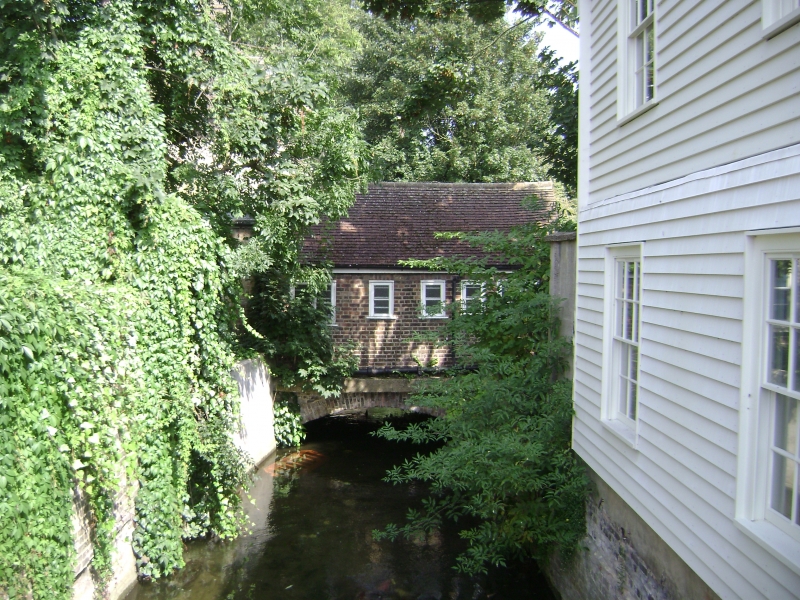
1. HIGH STREET
5274 (South Side)
The Bridge House
TQ 5473 3/4 22.12.53.
II GV
2.
C18. 2 storeys and attics brown brick. Hipped tiled roof. 4 windows and 2 dormers
facing north, 4 windows and 2 dormers facing east, 3 windows facing west. Glazing
bars intact. Dommay in west front set in moulded architrave surround with pediment
over on console brackets. On the west side there is a 2 storey C19 extension in
matching style with hipped tiled roof and 1 sash with glazing bars intact.
The Bridge House, Acacia Hall and the Mill Building to rear of Bridge House form
a group. (The Mill building is a local interest building).
Listing NGR: TQ5442673945
External links are from the relevant listing authority and, where applicable, Wikidata. Wikidata IDs may be related buildings as well as this specific building. If you want to add or update a link, you will need to do so by editing the Wikidata entry.


Other nearby listed buildings
