Latitude: 51.3371 / 51°20'13"N
Longitude: 1.4296 / 1°25'46"E
OS Eastings: 638974
OS Northings: 165359
OS Grid: TR389653
Mapcode National: GBR X0M.289
Mapcode Global: VHMCW.QNMC
Plus Code: 9F338CPH+RR
Entry Name: Boundary Wall to Coastguard Cottages, East, South and West of Courtyard
Listing Date: 4 February 1988
Grade: II
Source: Historic England
Source ID: 1086072
English Heritage Legacy ID: 172048
ID on this website: 101086072
Location: Ramsgate, Thanet, Kent, CT11
County: Kent
District: Thanet
Civil Parish: Ramsgate
Built-Up Area: Ramsgate
Traditional County: Kent
Lieutenancy Area (Ceremonial County): Kent
Tagged with: Wall
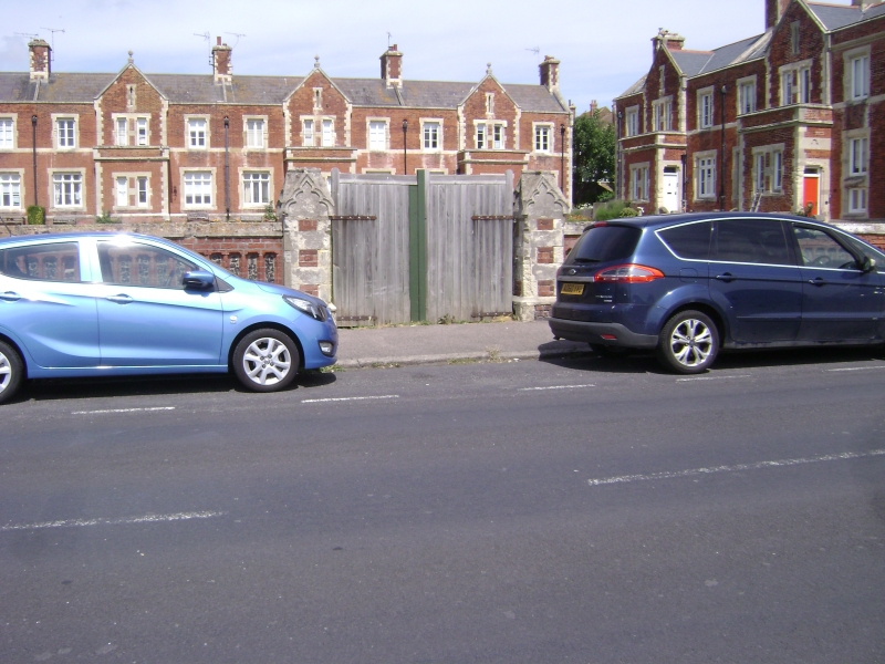
RAMSGATE VICTORIA PARADE TR 3865 SE (south side) 10/412 Boundary wall to Coastguard Cottages, east, south and west of courtyard GV II Boundary wall to courtyard station complex. 1865. Red brick and flint with ashlar dressings. About 4 feet high on plinth with flint panelling,arcading and stone coping, running along whole road frontage of complex and returned left and right to cottages. Finished and returned at either end by piers with caps, about 4 feet. Front range includes 3 entrance breaks with cusped finialed piers. (Busson, Ramsgate, 107).
Listing NGR: TR3897465359
External links are from the relevant listing authority and, where applicable, Wikidata. Wikidata IDs may be related buildings as well as this specific building. If you want to add or update a link, you will need to do so by editing the Wikidata entry.


Other nearby listed buildings