Approximate Location Map
Large Map »
Latitude: 51.3316 / 51°19'53"N
Longitude: 1.414 / 1°24'50"E
OS Eastings: 637922
OS Northings: 164704
OS Grid: TR379647
Mapcode National: GBR X0L.JB7
Mapcode Global: VHMCW.GSDK
Plus Code: 9F338CJ7+JJ
Entry Name: 12, West Cliff Road
Listing Date: 13 September 1974
Grade: II
Source: Historic England
Source ID: 1086077
English Heritage Legacy ID: 172063
ID on this website: 101086077
Location: Ramsgate, Thanet, Kent, CT11
County: Kent
District: Thanet
Civil Parish: Ramsgate
Built-Up Area: Ramsgate
Traditional County: Kent
Lieutenancy Area (Ceremonial County): Kent
Tagged with: Building
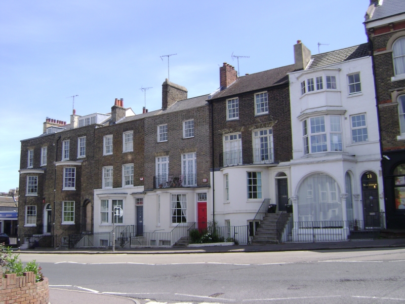
RAMSGATE WEST CLIFF ROAD
TR 3764 NE
(south side)
12/427 No. 12
13.9.74
GV II
Terrace house. Circa 1820. White stock brick, rendered on ground floor
and painted basement, with slate roof. Three storeys and basement with
parapet and stacks to left and to right. Two glazing bar sashes on 2nd
floor, and 2 French windows to 1st floor. Bow to basement and ground
with simple rails over as balcony to first floor. Glazing bar sashes to
bow. Door of 6 raised and fielded panels to right with semi-circular
fanlight and moulded surround, at head of flight of 8 steps, with
simple rails. Shown as already built on Collard and Hurst's 1821 map
of Ramsgate, with Nos. 8, 10 and 14 known as Wellington Place.
Listing NGR: TR3792264704
External links are from the relevant listing authority and, where applicable, Wikidata. Wikidata IDs may be related buildings as well as this specific building. If you want to add or update a link, you will need to do so by editing the Wikidata entry.


Other nearby listed buildings
