Approximate Location Map
Large Map »
Latitude: 51.3343 / 51°20'3"N
Longitude: 1.4241 / 1°25'26"E
OS Eastings: 638606
OS Northings: 165038
OS Grid: TR386650
Mapcode National: GBR X0M.6VT
Mapcode Global: VHMCW.MQQG
Plus Code: 9F338CMF+PJ
Entry Name: 62, the Plains of Waterloo
Listing Date: 4 February 1988
Grade: II
Source: Historic England
Source ID: 1086078
English Heritage Legacy ID: 171965
ID on this website: 101086078
Location: Ramsgate, Thanet, Kent, CT11
County: Kent
District: Thanet
Civil Parish: Ramsgate
Built-Up Area: Ramsgate
Traditional County: Kent
Lieutenancy Area (Ceremonial County): Kent
Tagged with: Building
RAMSGATE THE PLAINS OF
TR 3865 SE
WATERLOO
(east side)
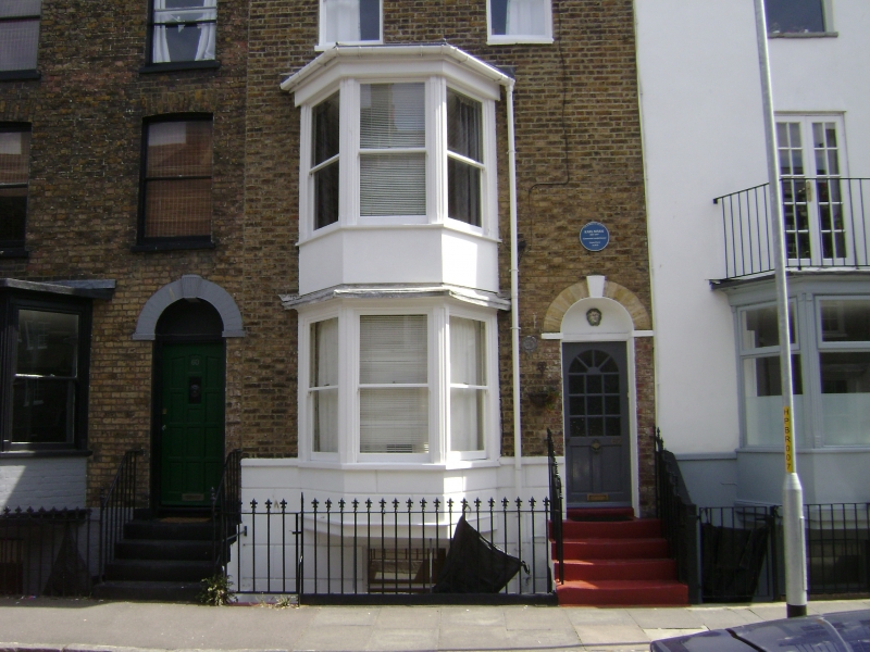
10/326 No. 62
GV II
Terrace house. 1820's. Stock brick, part rendered. Three storeys and
rusticated basement with parapet and stack to right. Two sashes on 2nd
floor, with 2 storey canted bay below with sashes in moulded architraves.
Half-glazed door to right in keyed semi-circular surround with 4 steps.
Listing NGR: TR3860665038
External links are from the relevant listing authority and, where applicable, Wikidata. Wikidata IDs may be related buildings as well as this specific building. If you want to add or update a link, you will need to do so by editing the Wikidata entry.


Other nearby listed buildings
