Latitude: 51.2494 / 51°14'57"N
Longitude: 0.6176 / 0°37'3"E
OS Eastings: 582774
OS Northings: 153279
OS Grid: TQ827532
Mapcode National: GBR QSW.LYR
Mapcode Global: VHJMG.NVBL
Plus Code: 9F326JX9+Q2
Entry Name: Oast Circa 13 Yards South East of Battel Hall
Listing Date: 14 December 1984
Grade: II
Source: Historic England
Source ID: 1086121
English Heritage Legacy ID: 173813
ID on this website: 101086121
Location: Ashbank, Maidstone, Kent, ME17
County: Kent
District: Maidstone
Civil Parish: Leeds
Traditional County: Kent
Lieutenancy Area (Ceremonial County): Kent
Tagged with: Building
LEEDS BURBERRY LANE TQ 8253 (west side)
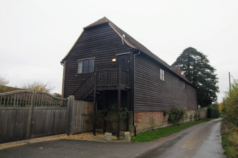
8/80 Oast circa 13 yards south- east of Battel Hall GV II Oast. Early C19. Lower half of ground floor and south gable end and whole of west elevation and north gable end chequered red and grey brick. Rest of first floor weatherboarded. Half-hipped plain tile roof. Stowage with internal kiln to right end. Road elevation has 3 small boarded hatches at varying heights within weatherboarding and blocked ground-floor door towards west end. Conical lead-capped kiln roof protruding from ridge almost at right end. Interior not inspected.
Listing NGR: TQ8277253280
External links are from the relevant listing authority and, where applicable, Wikidata. Wikidata IDs may be related buildings as well as this specific building. If you want to add or update a link, you will need to do so by editing the Wikidata entry.


Other nearby listed buildings