Latitude: 51.25 / 51°14'59"N
Longitude: 0.6145 / 0°36'52"E
OS Eastings: 582559
OS Northings: 153338
OS Grid: TQ825533
Mapcode National: GBR QSW.D6H
Mapcode Global: VHJMG.LVQ4
Plus Code: 9F326JX7+XR
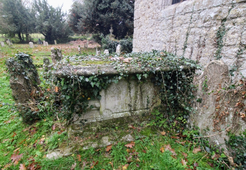
Entry Name: Table Tomb One Foot East of Chancel of Church of St Nicholas
Listing Date: 14 December 1984
Grade: II
Source: Historic England
Source ID: 1086129
English Heritage Legacy ID: 173824
ID on this website: 101086129
Location: St Nicholas's Church, Ashbank, Maidstone, Kent, ME17
County: Kent
District: Maidstone
Civil Parish: Leeds
Traditional County: Kent
Lieutenancy Area (Ceremonial County): Kent
Tagged with: Table tomb Table tomb
LEEDS LOWER STREET TQ 8253 (east side)
8/91 Table tomb one foot east of chancel of Church of St. Nicholas GV II
Table tomb. Late C18. Stone on stonebase with moulded plinth and corniced lid. Gadrooned side pilasters. Inscribed area has fielded panels with concave corners. Inscription illegible at time of resurvey.
Listing NGR: TQ8256053338
External links are from the relevant listing authority and, where applicable, Wikidata. Wikidata IDs may be related buildings as well as this specific building. If you want to add or update a link, you will need to do so by editing the Wikidata entry.


Other nearby listed buildings