Approximate Location Map
Large Map »
Latitude: 51.2393 / 51°14'21"N
Longitude: 0.6642 / 0°39'51"E
OS Eastings: 586070
OS Northings: 152275
OS Grid: TQ860522
Mapcode National: GBR QT4.6R8
Mapcode Global: VHJMP.G3HS
Plus Code: 9F326MQ7+PM
Entry Name: Pollhill Mill
Listing Date: 14 December 1984
Grade: II
Source: Historic England
Source ID: 1086155
English Heritage Legacy ID: 173784
ID on this website: 101086155
Location: Harrietsham, Maidstone, Kent, ME17
County: Kent
District: Maidstone
Civil Parish: Harrietsham
Traditional County: Kent
Lieutenancy Area (Ceremonial County): Kent
Tagged with: Mill
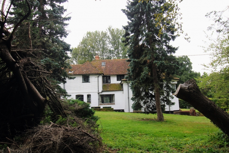
HARRIETSHAM POLL HILL
TQ 85 SE
4/51 Pollhill Mill
GV II
House. Mid C16 with C17, late C18 and late C19 alterations. Timber-
framed, rendered, with plain tile roof. 2 storeys and attics on
brick plinth, with continuous jetty to front, rear and left end,
on plain brackets. Right end altered. Hipped roof with gablets.
Multiple brick stack in rear slope of roof, off-centre to left.
One early C19 dormer to right. Irregular fenestration of 3 windows;
2 two-light and 1 three-light casement. Boarded door in right end
bay. Late C18 or early C19 addition to left half of front elevation,
forming double depth. Timber framed, faced with channeled stucco
with separate plain tile roof. Stack to right. One glazing-bar
sash. Panelled door. Late C19 facade added to whole of left
side elevation, largely obscuring jetty; channeled stucco, recessed
sashes with horns, vermiculated keystone to ground=floor windows.
Late C19 lean-to to right. Interior: 4 bays. Large inglenook
with moulded stone jambs and double-corbelled top to left jamb (C20
bressumer). Front wall post of principal ground-floor room has
blank shield carved under bracket beneath cross-beam. Tension
braces to walls and partitions. Chamfered beams. Gunstock jowls.
Plaincflown-posts with 2 curved downward and 2 upward braces. Attic
floored, possibly in C17 and partitioned, with C19 corn-bins
to one of central bays, and access in right end bay. C18 niche
by stack in ground-floor left end bay.
Listing NGR: TQ8607052275
External links are from the relevant listing authority and, where applicable, Wikidata. Wikidata IDs may be related buildings as well as this specific building. If you want to add or update a link, you will need to do so by editing the Wikidata entry.


Other nearby listed buildings
