Approximate Location Map
Large Map »
Latitude: 51.2725 / 51°16'21"N
Longitude: 0.5795 / 0°34'46"E
OS Eastings: 580031
OS Northings: 155757
OS Grid: TQ800557
Mapcode National: GBR PR9.3BR
Mapcode Global: VHJMG.087T
Plus Code: 9F327HFH+2R
Entry Name: Maybank
Listing Date: 23 May 1967
Last Amended: 20 July 1984
Grade: II
Source: Historic England
Source ID: 1086259
English Heritage Legacy ID: 173517
ID on this website: 101086259
Location: Ware Street, Maidstone, Kent, ME14
County: Kent
District: Maidstone
Civil Parish: Bearsted
Built-Up Area: Maidstone
Traditional County: Kent
Lieutenancy Area (Ceremonial County): Kent
Tagged with: Building
TQ 85 NW BEARSTED CHURCH LANE
(west side)
6/10 Maybank
23.5.67 (formerly listed under
The Green)
GV II
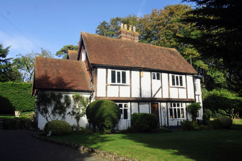
House. Late C16 or early C17 with C19 parallel rear range. Timber
framed with painted brick infilling and tile-hung gable ends.
Plain tile roof. 2 storeys with first-floor jettied on brackets.
Central rear stack. Irregular fenestration of 3 windows on
first cloor and 2 on ground floor; large C20 casements. Central
C20 door. 2-storey rear range, red brick with tile-hung gable.
C20 north and south extensions.
Listing NGR: TQ8006055736
External links are from the relevant listing authority and, where applicable, Wikidata. Wikidata IDs may be related buildings as well as this specific building. If you want to add or update a link, you will need to do so by editing the Wikidata entry.


Other nearby listed buildings
