Latitude: 51.2767 / 51°16'36"N
Longitude: 0.5079 / 0°30'28"E
OS Eastings: 575021
OS Northings: 156051
OS Grid: TQ750560
Mapcode National: GBR PR0.WRW
Mapcode Global: VHJMD.R5DL
Plus Code: 9F327GG5+M5
Entry Name: Somerfield Terrace
Listing Date: 2 August 1974
Grade: II
Source: Historic England
Source ID: 1086330
English Heritage Legacy ID: 173389
ID on this website: 101086330
Location: Maidstone, Kent, ME16
County: Kent
District: Maidstone
Electoral Ward/Division: Bridge
Parish: Non Civil Parish
Built-Up Area: Maidstone
Traditional County: Kent
Lieutenancy Area (Ceremonial County): Kent
Tagged with: Building
LONDON ROAD 1. 5278 (South West Side) Nos 63 to 77 (odd) (Somerfield Terrace) TQ 75 NE 9/301 II GV
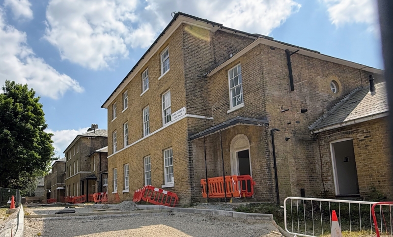
2. 4 blocks of semi-detached villas circa 1850 believed to have been built for the officers in the Barracks. 3 storeys stock brick. Hipped slate roofs and eaves cornice. Stringcourse between ground and 1st floors. 2 sashes with most glazing bars intact to each. Recessed portions of 2 storeys 1 bay to each. Entrances in the recessed extensions have fine cast iron anthemion motif porches, except for Nos 67 and 69 which have lost theirs.
Nos 6l to 77 (odd) form a group.
Listing NGR: TQ7503756016
External links are from the relevant listing authority and, where applicable, Wikidata. Wikidata IDs may be related buildings as well as this specific building. If you want to add or update a link, you will need to do so by editing the Wikidata entry.


Other nearby listed buildings