Approximate Location Map
Large Map »
Latitude: 51.2718 / 51°16'18"N
Longitude: 0.5247 / 0°31'29"E
OS Eastings: 576210
OS Northings: 155547
OS Grid: TQ762555
Mapcode National: GBR PR7.7G9
Mapcode Global: VHJMF.19RC
Plus Code: 9F327GCF+PV
Entry Name: 22, Lower Stone Street
Listing Date: 2 August 1974
Grade: II
Source: Historic England
Source ID: 1086333
English Heritage Legacy ID: 173397
ID on this website: 101086333
Location: Maidstone, Kent, ME15
County: Kent
District: Maidstone
Electoral Ward/Division: High Street
Parish: Non Civil Parish
Built-Up Area: Maidstone
Traditional County: Kent
Lieutenancy Area (Ceremonial County): Kent
Tagged with: Building
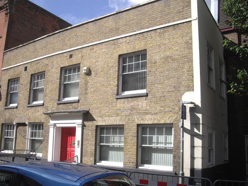
LOWER STONE STREET
1.
5278
(West Side)
No 22
TQ 7655 NW 2/37
II
2.
Early C19. 2 storeys yellow brick. Parapet. 4 sashes with glazing bars missing.
2 doorways with pilasters and projecting cornice, one with a door of 8 fielded
panels.
Listing NGR: TQ7619755540
External links are from the relevant listing authority and, where applicable, Wikidata. Wikidata IDs may be related buildings as well as this specific building. If you want to add or update a link, you will need to do so by editing the Wikidata entry.


Other nearby listed buildings
