Latitude: 51.3876 / 51°23'15"N
Longitude: 0.5016 / 0°30'5"E
OS Eastings: 574156
OS Northings: 168360
OS Grid: TQ741683
Mapcode National: GBR PPN.TYC
Mapcode Global: VHJLT.ND04
Plus Code: 9F329GQ2+2J
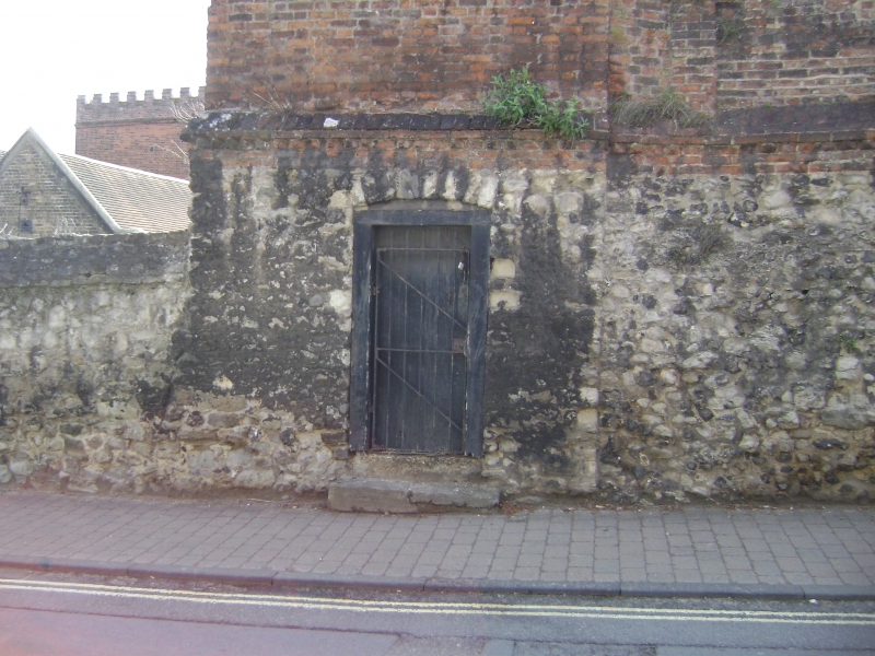
Entry Name: Walls Enclosing Archdeaconry Gardens
Listing Date: 2 December 1991
Grade: II
Source: Historic England
Source ID: 1086432
English Heritage Legacy ID: 173141
ID on this website: 101086432
Location: Rochester, Medway, Kent, ME1
County: Medway
Electoral Ward/Division: Rochester West
Parish: Non Civil Parish
Built-Up Area: Rochester
Traditional County: Kent
Lieutenancy Area (Ceremonial County): Kent
Church of England Parish: Rochester St Peter Parish Centre
Church of England Diocese: Rochester
Tagged with: Wall
ROCHESTER ST MARGARET ' S TQ 7468 SW STREET (AND VINES LANE ) 9/208 Walls enclosing A r c h d e a c o n r y Gardens GV II Walls. C17, C18 and C19. Clunch, ragstone rubble and brick upper courses to St Margaret's Street, brick with piers to Vines Lane. Triangular coping with brick dentillation along St Margaret's Street. The city wall is attached to NW.
Listing NGR: TQ7414668330
External links are from the relevant listing authority and, where applicable, Wikidata. Wikidata IDs may be related buildings as well as this specific building. If you want to add or update a link, you will need to do so by editing the Wikidata entry.


Other nearby listed buildings