Latitude: 51.3908 / 51°23'26"N
Longitude: 0.503 / 0°30'10"E
OS Eastings: 574244
OS Northings: 168725
OS Grid: TQ742687
Mapcode National: GBR PPN.N0X
Mapcode Global: VHJLT.N9SN
Plus Code: 9F329GR3+86
Entry Name: 17 High Street
Listing Date: 19 February 1970
Last Amended: 2 December 1991
Grade: II
Source: Historic England
Source ID: 1086470
English Heritage Legacy ID: 173036
ID on this website: 101086470
Location: Rochester, Medway, Kent, ME1
County: Medway
Electoral Ward/Division: Rochester West
Parish: Non Civil Parish
Built-Up Area: Rochester
Traditional County: Kent
Lieutenancy Area (Ceremonial County): Kent
Church of England Parish: Rochester St Peter Parish Centre
Church of England Diocese: Rochester
Tagged with: Building
This list entry was subject to a Minor Amendment on 12 May 2025 to amend the name and address, amend description due to a change of building use and reformat the text to current standards
TQ 7468 NW
7/106
ROCHESTER
HIGH STREET
No 17
(Formerly listed as Wing to south east of The Guildhall (Citizens' Advice Bureau) previously listed as Right Wing to Guildhall)
19.2.70
GV
II
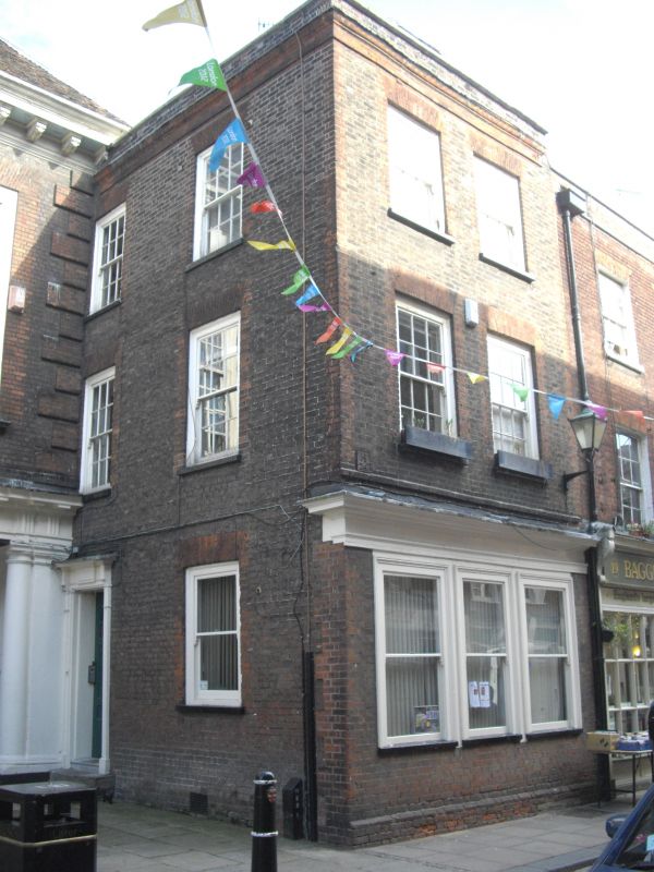
Former house, at time of listing offices and Citizens' Advice Bureau. Late C18. Gault brick with red brick dressings; Kent-tile hipped roof. Three storeys.
Front: symmetrical two-window range. Parapet with stone coping; moulded brick cornice. Upper floors have twelve-pane horned sashes in revealed frames under rubbed brick window arches. Early C20 tripartite sash window under moulded cornice to ground floor. Left return, also a two-window range with identical details; ground floor with plate glass sash window and doorway with cornice and deep reveals; panelled door.
Interior not inspected.
Listing NGR: TQ7423468756
External links are from the relevant listing authority and, where applicable, Wikidata. Wikidata IDs may be related buildings as well as this specific building. If you want to add or update a link, you will need to do so by editing the Wikidata entry.


Other nearby listed buildings