Approximate Location Map
Large Map »
Latitude: 54.5528 / 54°33'10"N
Longitude: -3.5986 / 3°35'54"W
OS Eastings: 296707
OS Northings: 518683
OS Grid: NX967186
Mapcode National: GBR 3H9S.QQ
Mapcode Global: WH5Z1.PTLM
Plus Code: 9C6RHC32+4H
Entry Name: West Pier Lighthouse
Listing Date: 13 September 1972
Grade: II
Source: Historic England
Source ID: 1086806
English Heritage Legacy ID: 75898
Also known as: Whitehaven Head Of West Pier Light
Whitehaven West Pier light
ID on this website: 101086806
Location: Whitehaven, Cumberland, Cumbria, CA28
County: Cumbria
District: Copeland
Civil Parish: Whitehaven
Built-Up Area: Whitehaven
Lieutenancy Area (Ceremonial County): Cumbria
Church of England Parish: Kells St Peter
Church of England Diocese: Carlisle
Tagged with: Lighthouse
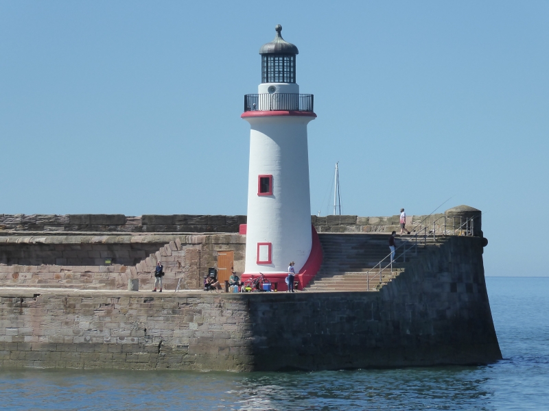
West Pier Lighthouse
1.
1814
NX 91 NE 2/7
II
2.
Simple stone lighthouse with glazed lantern and ogival cupola, probably
circa 1839.
Listing NGR: NX9670718683
External links are from the relevant listing authority and, where applicable, Wikidata. Wikidata IDs may be related buildings as well as this specific building. If you want to add or update a link, you will need to do so by editing the Wikidata entry.


Other nearby listed buildings
