Approximate Location Map
Large Map »
Latitude: 51.3522 / 51°21'7"N
Longitude: 1.0232 / 1°1'23"E
OS Eastings: 610606
OS Northings: 165795
OS Grid: TR106657
Mapcode National: GBR TX7.1J8
Mapcode Global: VHKJR.P88R
Plus Code: 9F33922F+V7
Entry Name: The Stables of the Brewers Public House to the North West
Listing Date: 20 May 1977
Grade: II
Source: Historic England
Source ID: 1086937
English Heritage Legacy ID: 170796
ID on this website: 101086937
Location: Lower Island, Canterbury, Kent, CT5
County: Kent
District: Canterbury
Electoral Ward/Division: Gorrell
Parish: Non Civil Parish
Built-Up Area: Whitstable
Traditional County: Kent
Lieutenancy Area (Ceremonial County): Kent
Tagged with: Stable
CANTERBURY ROAD
1.
5273
(North-West Side)
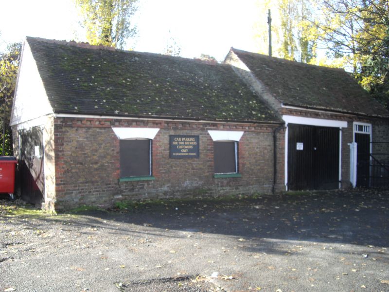
The Stables of the
Brewers Public House
to the north-west.
TR 16 NW 4/79A
II
2.
Late C18 to early C19. Brick built stable buildings with double doors, old clay
tiled roof, stable door with ventilating bars over transom. 2 windows complete.
Listing NGR: TR1061965812
External links are from the relevant listing authority and, where applicable, Wikidata. Wikidata IDs may be related buildings as well as this specific building. If you want to add or update a link, you will need to do so by editing the Wikidata entry.


Other nearby listed buildings
