Latitude: 54.9004 / 54°54'1"N
Longitude: -2.7236 / 2°43'25"W
OS Eastings: 353691
OS Northings: 556430
OS Grid: NY536564
Mapcode National: GBR 9CFS.43
Mapcode Global: WH806.4392
Plus Code: 9C6VW72G+5G
Entry Name: Greenwell Farmhouse, Barns and Adjoining Outbuildings
Listing Date: 28 March 1984
Grade: II
Source: Historic England
Source ID: 1087545
English Heritage Legacy ID: 78036
ID on this website: 101087545
Location: Greenwell, Cumberland, Cumbria, CA8
County: Cumberland
District: Carlisle
Civil Parish: Hayton
Traditional County: Cumberland
Lieutenancy Area (Ceremonial County): Cumbria
Church of England Parish: Hayton St Mary Magdalene
Church of England Diocese: Carlisle
Tagged with: Building
NY 55 NW HAYTON GREENWELL
5/45 Greenwell Farmhouse, barns and adjoining outbuildings
II
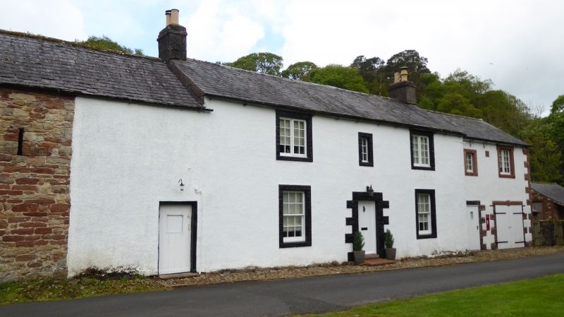
Farmhouse and barns adjoining. Probably early C18, incorporating earlier features, with early C19 alterations; barn extension dated 1774 with initials J. (&) M.H., over entrance. 2 storeys, 3-bay farmhouse. Plank door and sash windows with glazing bars have rusticated stone surrounds of the early C19; smaller window above entrance is probably original. Barn to left is contemporary with house. Plank doors and slit vents; loft door has external stone steps. Further extension to barn left, has large plank doors with keyed arch, dated and initialled keystone. Painted quoins and slit vents. Single storey outbuildings to right (now used as garage) have plank doors and similar surrounds to house. Former C19, 2 bay pigsties adjoin to right. Victorian wall letter-box in outbuilding wall. Deeds go back to 1684 and in C19 formed part of the estate of the Earl of Carlisle.
Listing NGR: NY5369156430
External links are from the relevant listing authority and, where applicable, Wikidata. Wikidata IDs may be related buildings as well as this specific building. If you want to add or update a link, you will need to do so by editing the Wikidata entry.


Other nearby listed buildings