Latitude: 54.8716 / 54°52'17"N
Longitude: -2.7073 / 2°42'26"W
OS Eastings: 354706
OS Northings: 553211
OS Grid: NY547532
Mapcode National: GBR 9DJ3.NG
Mapcode Global: WH806.DT17
Plus Code: 9C6VV7CV+J3
Entry Name: Barn to North East of Manor House
Listing Date: 28 March 1984
Grade: II
Source: Historic England
Source ID: 1087568
English Heritage Legacy ID: 77993
ID on this website: 101087568
Location: Brackenthwaite, Cumberland, Cumbria, CA8
County: Cumberland
District: Carlisle
Civil Parish: Castle Carrock
Traditional County: Cumberland
Lieutenancy Area (Ceremonial County): Cumbria
Church of England Parish: Castle Carrock St Peter
Church of England Diocese: Carlisle
Tagged with: Barn
NY 55 SW CASTLE CARROCK BRACKENTHWAITE
9/2 Barn to north-east of Manor House
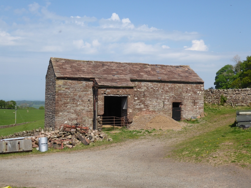
II Barn, formerly house and barn. Dated 1700, with initials I.H. over entrance. Mixed sandstone rubble walls, sandstone slate roof. 2 storeys, single bay house and single bay barn under common roof. Entrance surround has carved recess for door; chamfered lintel with carved panel of initials and date, with carved hood mould. Filled square window above. Slit vents to ground floor of house with slit vents to upper part of barn. Large projecting cart entrance to left is a C19 addition; filled smaller entrance to left. Slit vents to left end wall; loft door to right end wall is C19 alteration. Rear wall has small square window to house and ground floor entrance to barn now filled. Adjoining barns to Manor house are listed separately in Cumrew C.P.
Listing NGR: NY5470653211
External links are from the relevant listing authority and, where applicable, Wikidata. Wikidata IDs may be related buildings as well as this specific building. If you want to add or update a link, you will need to do so by editing the Wikidata entry.


Other nearby listed buildings