Approximate Location Map
Large Map »
Latitude: 53.2236 / 53°13'24"N
Longitude: -1.5693 / 1°34'9"W
OS Eastings: 428849
OS Northings: 369698
OS Grid: SK288696
Mapcode National: GBR 57R.S3B
Mapcode Global: WHCD8.V7WL
Plus Code: 9C5W6CFJ+C7
Entry Name: Guidestone at OS288696
Listing Date: 19 June 1987
Grade: II
Source: Historic England
Source ID: 1088229
English Heritage Legacy ID: 81570
ID on this website: 101088229
Location: Derbyshire Dales, Derbyshire, DE45
County: Derbyshire
District: Derbyshire Dales
Civil Parish: Baslow and Bubnell
Traditional County: Derbyshire
Lieutenancy Area (Ceremonial County): Derbyshire
Church of England Parish: Baslow St Anne
Church of England Diocese: Derby
PARISH OF BASLOW & BUBNELL BEELEY MOOR
SK 26 NE
5/5
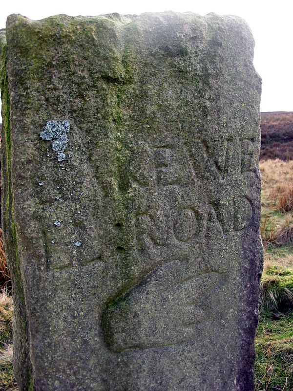
Guidestone at
OS288696
II
Guidepost. Gritstone. Square in plan, and about five feet
tall. Inscribed CHESTE/ RFIELD/ ROAD and BAKEWE/ LL ROAD, each
with a hand and pointing finger below.
Listing NGR: SK2884969697
External links are from the relevant listing authority and, where applicable, Wikidata. Wikidata IDs may be related buildings as well as this specific building. If you want to add or update a link, you will need to do so by editing the Wikidata entry.


Other nearby listed buildings
