Latitude: 51.8092 / 51°48'33"N
Longitude: -2.0492 / 2°2'56"W
OS Eastings: 396707
OS Northings: 212290
OS Grid: SO967122
Mapcode National: GBR 2NB.JQQ
Mapcode Global: VHB23.FSKD
Plus Code: 9C3VRX52+M8
Entry Name: Unidentified Monument in the Churchyard Approximatley 1.5M South of Church of St John
Listing Date: 24 June 1985
Grade: II*
Source: Historic England
Source ID: 1088445
English Heritage Legacy ID: 127217
ID on this website: 101088445
Location: St John's Church, Elkstone, Cotswold, Gloucestershire, GL53
County: Gloucestershire
District: Cotswold
Civil Parish: Elkstone
Traditional County: Gloucestershire
Lieutenancy Area (Ceremonial County): Gloucestershire
Church of England Parish: Elkstone St John the Evangelist
Church of England Diocese: Gloucester
Tagged with: Monument
SO 91 SE ELKSTONE ELKSTONE VILLAGE
3/117 Unidentified monument in the churchyard approximately 1.5m south of Church of St. John
GV II*
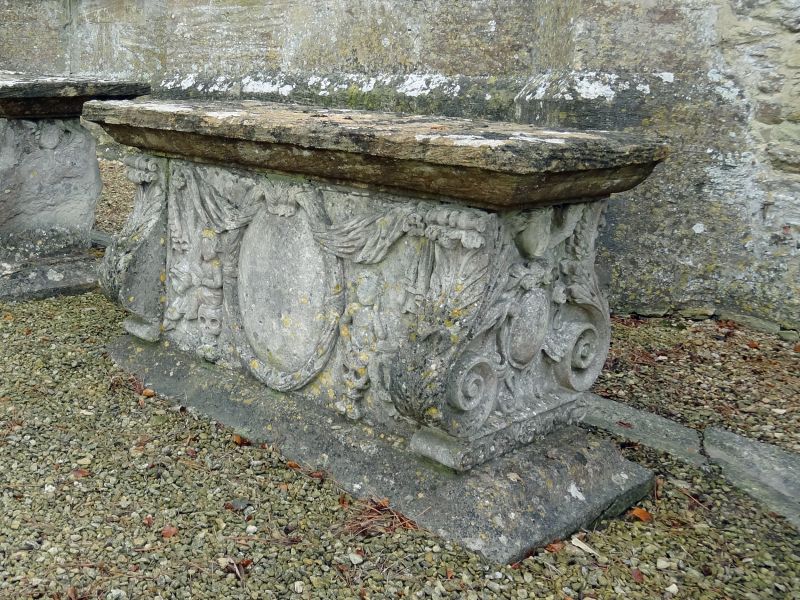
Chest tomb. Dated 1692. Limestone. Finely carved lyre ends each with 3-dimensional oval with scrolled border and cherub's head with wings over; acanthus leaf carving to sides of lyre ends. Oval inscription panel with border representing bound cloth; swags draped between top of panel and projecting rosettes in upper corners; panel flanked by putti sitting on skulls; inscription illegible apart from date. Plain recessed quatrefoil panel on north side. Thick cyma moulded top and base. Said to be the memorial to a member of the Poole family, possibly Nathaniel Poole a local cloth trader. A very well preserved example of high quality craftsmanship.
Listing NGR: SO9670712290
External links are from the relevant listing authority and, where applicable, Wikidata. Wikidata IDs may be related buildings as well as this specific building. If you want to add or update a link, you will need to do so by editing the Wikidata entry.


Other nearby listed buildings