Approximate Location Map
Large Map »
Latitude: 51.9293 / 51°55'45"N
Longitude: -1.7243 / 1°43'27"W
OS Eastings: 419054
OS Northings: 225680
OS Grid: SP190256
Mapcode National: GBR 4Q2.2VB
Mapcode Global: VHBZ5.2R9V
Plus Code: 9C3WW7HG+P7
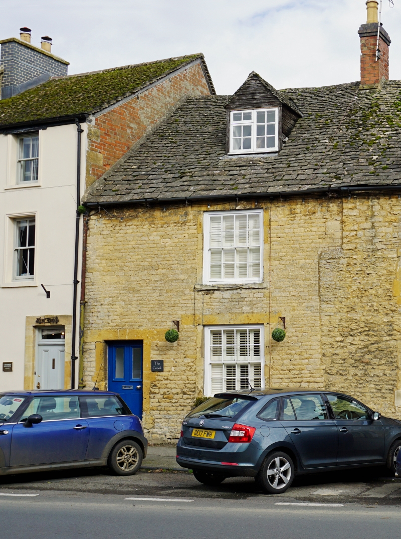
Entry Name: The Crook
Listing Date: 29 April 1983
Grade: II
Source: Historic England
Source ID: 1088813
English Heritage Legacy ID: 126356
ID on this website: 101088813
Location: Stow-on-the-Wold, Cotswold, Gloucestershire, GL54
County: Gloucestershire
District: Cotswold
Civil Parish: Stow-on-the-Wold
Built-Up Area: Stow-on-the-Wold
Traditional County: Gloucestershire
Lieutenancy Area (Ceremonial County): Gloucestershire
Church of England Parish: Stow-on-the Wold St Edward
Church of England Diocese: Gloucester
Tagged with: Building
1.
5224 SHEEP STREET
(north side)
The Crook
SP 1925 NW 2/48
II GV
2.
C18. Coursed rubble with Cotswold stone roof. Two storeys and attic, one window,
16 pane sashes. Plain doorway in reveal to left. Flat topped dour, stone stack.
Listing NGR: SP1905425680
External links are from the relevant listing authority and, where applicable, Wikidata. Wikidata IDs may be related buildings as well as this specific building. If you want to add or update a link, you will need to do so by editing the Wikidata entry.


Other nearby listed buildings
