Latitude: 51.6387 / 51°38'19"N
Longitude: -2.3491 / 2°20'56"W
OS Eastings: 375938
OS Northings: 193380
OS Grid: ST759933
Mapcode National: GBR 0MF.6XM
Mapcode Global: VH95G.72HL
Plus Code: 9C3VJMQ2+F9
Entry Name: The Court
Listing Date: 16 August 1984
Grade: II*
Source: Historic England
Source ID: 1088914
English Heritage Legacy ID: 128099
ID on this website: 101088914
Location: Wotton-under-Edge, Stroud, Gloucestershire, GL12
County: Gloucestershire
District: Stroud
Civil Parish: Wotton-under-Edge
Built-Up Area: Wotton-under-Edge
Traditional County: Gloucestershire
Lieutenancy Area (Ceremonial County): Gloucestershire
Church of England Parish: Wotton-under-Edge with Ozleworth
Church of England Diocese: Gloucester
Tagged with: Building
ST 7693 4/39 WOTTON-UNDER-EDGE CULVERHAY 23.6.52 (south)
The Court
II*
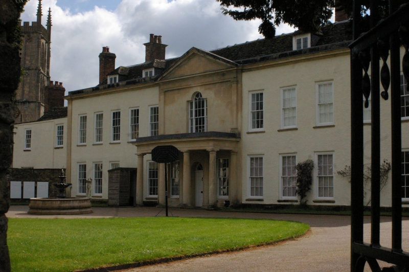
Large detached house, one time Rectory. Early C18. Rendered rubble, stone parapet cornice, stone slate roof. Tripartite main front centre with wide classical pediment deep projecting portico, pilasters above; hipped roof with central flat in principal block, right, and single span narrower block left. Four brick stacks with moulded stone cappings. Two storey plus dormers, five, three, five windowed, all sashes with glazing bars in wide surrounds and stone bull-nosed cills; central section venetian window first floor, two sashes ground floor flanking six-panel door with decorative fanlight. Dormers with hipped roofs, two light casements retaining rectangular leaded glazing. Four-columned doric porch with responds, flat entablature. Good nineteenth century staircase and staircase hall, panelled doors in deep reveals, modillion cornice and classical detail generally some replacement but in keeping. Arched opening with fluted pilasters, left. Panelled and painted room right of entrance hall; and in study, back right. Building of at least two major campaigns; mostly of ca.1727, but extension and alteration, including main portico, about 1830. On glebe land, and known as Old Rectory until change of name.
Listing NGR: ST7593893380
External links are from the relevant listing authority and, where applicable, Wikidata. Wikidata IDs may be related buildings as well as this specific building. If you want to add or update a link, you will need to do so by editing the Wikidata entry.


Other nearby listed buildings