Latitude: 51.6706 / 51°40'13"N
Longitude: -2.0174 / 2°1'2"W
OS Eastings: 398892
OS Northings: 196864
OS Grid: ST988968
Mapcode National: GBR 2Q4.6S8
Mapcode Global: VHB2W.Z8BP
Plus Code: 9C3VMXCM+62
Entry Name: Home Farmhouse
Listing Date: 27 February 1986
Grade: II
Source: Historic England
Source ID: 1089286
English Heritage Legacy ID: 129359
ID on this website: 101089286
Location: Kemble, Cotswold, Gloucestershire, GL7
County: Gloucestershire
District: Cotswold
Civil Parish: Kemble
Built-Up Area: Kemble
Traditional County: Wiltshire
Lieutenancy Area (Ceremonial County): Gloucestershire
Church of England Parish: Kemble All Saints
Church of England Diocese: Gloucester
Tagged with: Farmhouse
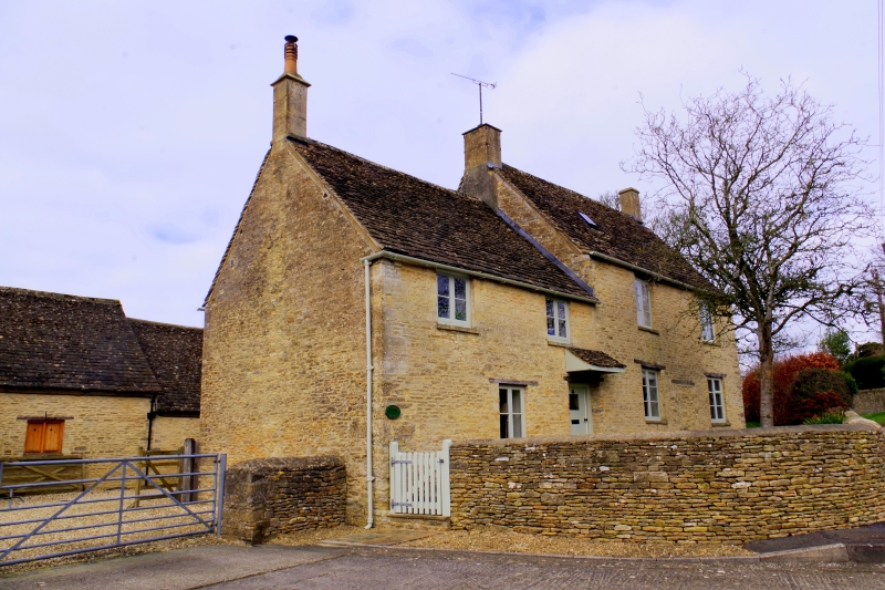
KEMBLE KEMBLE VILLAGE ST 99 NE 7/62 Home Farmhouse GV II Farmhouse. Early/mid C18. Random coursed rubble stone with quoins to left-hand side, stone slate roof to front, concrete tiles to rear, 3 stone end stacks. Single long range in 2 sections with lower older section to south of 2 storeys, section to north of 2 storeys and attic in gable end with rear extension with raking roof. Four windows, 2 paired wooden casements to each section, longer to right-hand side, all below eaves on first floor. Ground floor has one similar to left with timber lintel, doorway with large timber lintel and sloping tiled hood, boarded door with small single light. On right hand section, 2 paired casements as on first floor with central blocked doorway and timber lintel remaining.
Listing NGR: ST9889296864
External links are from the relevant listing authority and, where applicable, Wikidata. Wikidata IDs may be related buildings as well as this specific building. If you want to add or update a link, you will need to do so by editing the Wikidata entry.


Other nearby listed buildings