Latitude: 51.8867 / 51°53'12"N
Longitude: -1.9804 / 1°58'49"W
OS Eastings: 401445
OS Northings: 220905
OS Grid: SP014209
Mapcode National: GBR 2MG.Q3T
Mapcode Global: VHB1R.MVD0
Plus Code: 9C3WV2P9+MR
Entry Name: Barn on Corner of T Junction
Listing Date: 23 January 1952
Last Amended: 11 February 1986
Grade: II
Source: Historic England
Source ID: 1089319
English Heritage Legacy ID: 129232
ID on this website: 101089319
Location: Whittington, Cotswold, Gloucestershire, GL54
County: Gloucestershire
District: Cotswold
Civil Parish: Whittington
Traditional County: Gloucestershire
Lieutenancy Area (Ceremonial County): Gloucestershire
Church of England Parish: Whittington St Bartholomew
Church of England Diocese: Gloucester
Tagged with: Barn
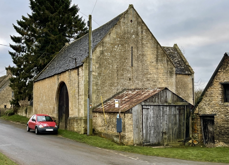
SP 02 SW WHITTINGTON MAIN STREET (south side) 2/127 Barn on corner of 'T' junction (formerly listed as Barn immediate 23.1.52 east of crossroads in village) GV II
Barn. Mid C18. Coursed squared and dressed limestone, stone slate roof. Asymmetrical 'T'-shaped plan with projecting porch on south side. Lean-to garden shed at left gable end and garage at right gable end, not of special interest. Double plank doors off-centre right within flat-chamfered semi-circular headed surround. Double doors to gabled porch entrance in wall opposite with pitching window right. Circular owl holes towards apex of each gable. Flat gable end coping with roll-cross saddles. Interior; 4 bays with king post trusses (not original). Barn resembles barn at Whalley Farm (q.v), which is dated 1740.
Listing NGR: SP0144520905
External links are from the relevant listing authority and, where applicable, Wikidata. Wikidata IDs may be related buildings as well as this specific building. If you want to add or update a link, you will need to do so by editing the Wikidata entry.


Other nearby listed buildings