Approximate Location Map
Large Map »
Latitude: 51.7454 / 51°44'43"N
Longitude: -1.773 / 1°46'22"W
OS Eastings: 415769
OS Northings: 205208
OS Grid: SP157052
Mapcode National: GBR 4S4.GLC
Mapcode Global: VHB2N.7D1C
Plus Code: 9C3WP6WG+4R
Entry Name: Barn at Glebe Farm
Listing Date: 4 June 1952
Grade: II
Source: Historic England
Source ID: 1089443
English Heritage Legacy ID: 128913
ID on this website: 101089443
Location: Hatherop, Cotswold, Gloucestershire, GL7
County: Gloucestershire
District: Cotswold
Civil Parish: Hatherop
Traditional County: Gloucestershire
Lieutenancy Area (Ceremonial County): Gloucestershire
Church of England Parish: Coln St Aldwyn St John the Baptist
Church of England Diocese: Gloucester
Tagged with: Barn
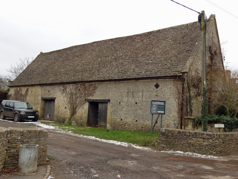
SP 10 NE HATHEROP HATHEROP VILLAGE
(east side)
2/72 Barn at Glebe Farm
4.6.52
GV II
Barn. Probably early C18. Rubblestone, stone slate roof with
coped verges. 5 bays of collar and tie beam trusses, divided by
internal partition wall as 2 to west and 3 to east. West bays
have flush cart entry with timber lintel and double doors nearer
centre, east bays have large projecting gabled cart entry, nearly
central along building, also with timber lintel and double doors
and with small light over and 3-holed dovecot above. Both entries
on south side have low level opposed entries on north side.
Square vents scattered throughout.
Listing NGR: SP1576905208
External links are from the relevant listing authority and, where applicable, Wikidata. Wikidata IDs may be related buildings as well as this specific building. If you want to add or update a link, you will need to do so by editing the Wikidata entry.


Other nearby listed buildings
