Latitude: 51.6377 / 51°38'15"N
Longitude: -2.1606 / 2°9'38"W
OS Eastings: 388984
OS Northings: 193225
OS Grid: ST889932
Mapcode National: GBR 1P0.6L0
Mapcode Global: VH95K.H3NC
Plus Code: 9C3VJRQQ+3Q
Entry Name: 29, Long Street
Listing Date: 6 September 1954
Grade: II
Source: Historic England
Source ID: 1089621
English Heritage Legacy ID: 128531
ID on this website: 101089621
Location: Tetbury, Cotswold, Gloucestershire, GL8
County: Gloucestershire
District: Cotswold
Civil Parish: Tetbury
Built-Up Area: Tetbury
Traditional County: Gloucestershire
Lieutenancy Area (Ceremonial County): Gloucestershire
Church of England Parish: Tetbury St Mary the Virgin
Church of England Diocese: Gloucester
Tagged with: Building
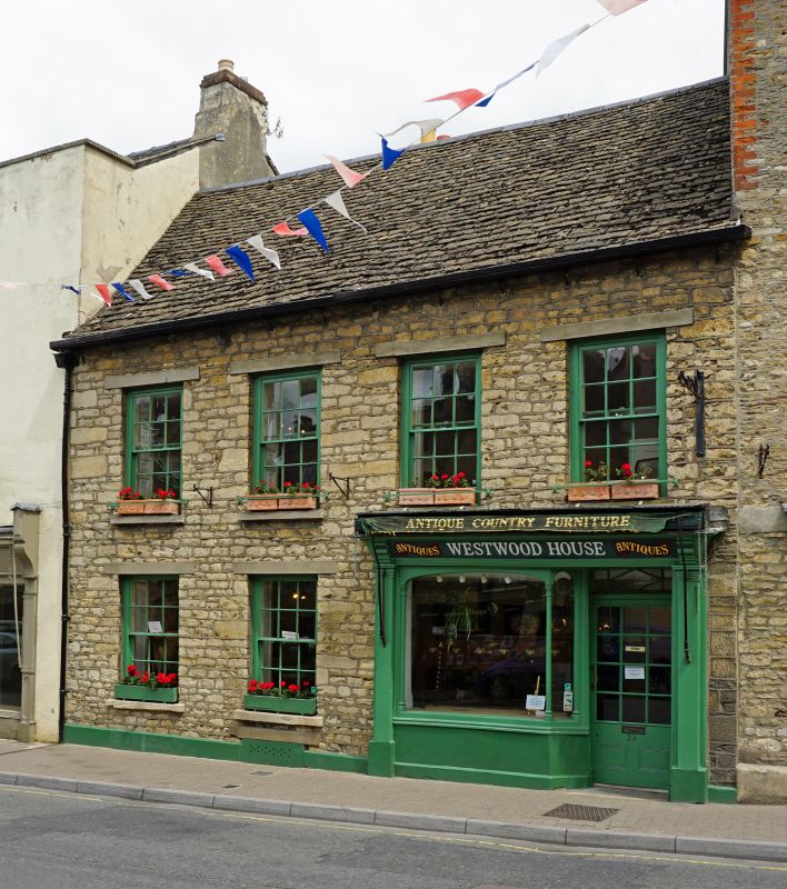
ST 8893-8993 TETBURY LONG STREET
(east side)
7/256 No 29
6.9.54
GV II
Small house in terrace. Early/mid C18. Rubble stone on cemented
plinth with Cotswold stone slate roof and rear stone stack. Double
range, 2 storeys. 4 windows, 12-pane sashes with concrete lintels.
Ground floor has 2 similar to left and small early C19 shop front
to right with half-glazed door to right and window framed by cast
iron colonnettes, and side pilasters and consoles.
Listing NGR: ST8898793230
External links are from the relevant listing authority and, where applicable, Wikidata. Wikidata IDs may be related buildings as well as this specific building. If you want to add or update a link, you will need to do so by editing the Wikidata entry.


Other nearby listed buildings