Latitude: 51.9046 / 51°54'16"N
Longitude: -1.6431 / 1°38'35"W
OS Eastings: 424649
OS Northings: 222957
OS Grid: SP246229
Mapcode National: GBR 5RP.KDZ
Mapcode Global: VHBZD.GDQ8
Plus Code: 9C3WW934+RQ
Entry Name: University Farmhouse
Listing Date: 25 August 1960
Grade: II
Source: Historic England
Source ID: 1089808
English Heritage Legacy ID: 130154
ID on this website: 101089808
Location: Bledington, Cotswold, Gloucestershire, OX7
County: Gloucestershire
District: Cotswold
Civil Parish: Bledington
Built-Up Area: Bledington
Traditional County: Gloucestershire
Lieutenancy Area (Ceremonial County): Gloucestershire
Church of England Parish: Bledington St Leonard
Church of England Diocese: Gloucester
Tagged with: Farmhouse
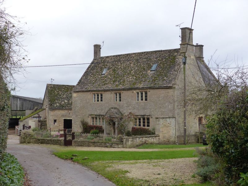
BLEDINGTON CHAPEL LANE SP 2422 (north side) 12/42 University Farmhouse 25.8.60 II Detached farmhouse. Late C17-early C18 with C19 extension. Coursed square and dressed limestone and sandstone, stone slate roof at front of main body, concrete tiles at rear, ashlar and artificial stone stacks to main body, slate roof to extension at rear with brick stack. 'L'-shaped plan to main body, extending back rear right, C19 extension onto gable-end at rear and in angle of 'L'. Symmetrical facade. 2 storeys, 3-windowed; 2, 3 and 4- light double-chamfered stone-mullioned casements with stopped hoods and horizontal glazing bars. Central C19 plank door with decorative hinges and single light at top. Former entrance in left gable end now blocked. Saddleback gable-end coping, gable-end stacks. Interior not inspected.
Listing NGR: SP2464922957
External links are from the relevant listing authority and, where applicable, Wikidata. Wikidata IDs may be related buildings as well as this specific building. If you want to add or update a link, you will need to do so by editing the Wikidata entry.


Other nearby listed buildings