Latitude: 51.893 / 51°53'34"N
Longitude: -2.2721 / 2°16'19"W
OS Eastings: 381370
OS Northings: 221645
OS Grid: SO813216
Mapcode National: GBR 0JF.8CF
Mapcode Global: VH944.KPP4
Plus Code: 9C3VVPVH+65
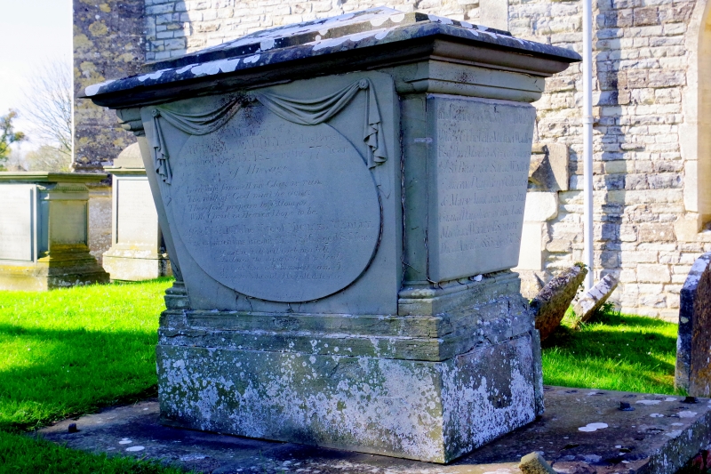
Entry Name: Wadley Monument in Churchyard About 2 Metres South West of Porch, Church of St Giles
Listing Date: 26 November 1986
Grade: II
Source: Historic England
Source ID: 1091375
English Heritage Legacy ID: 134353
ID on this website: 101091375
Location: St Giles's Church, Maisemore, Tewkesbury, Gloucestershire, GL2
County: Gloucestershire
District: Tewkesbury
Civil Parish: Maisemore
Traditional County: Gloucestershire
Lieutenancy Area (Ceremonial County): Gloucestershire
Church of England Parish: Maisemore St Giles
Church of England Diocese: Gloucester
Tagged with: Monument
MAISEMORE CHURCH ROAD SO 8021-8121 8/62 Wadley monument in churchyard, about 2m south west of porch, Church of St. Giles GV II
Chest tomb. M. Wadley, died 1826, J. Wadley, 1824. Stone. Weathered top, step, moulded edge to lid. Whole tapers downwards below; raised oval to sides with drapery caught up in centre and at ends over. Ends wide pilaster, plain on east, draped urn in sunk panel on west. Moulded top to high plinth, stone paving at ground level originally carrying iron railings. Later inscriptions: good lettering.
Listing NGR: SO8137021645
External links are from the relevant listing authority and, where applicable, Wikidata. Wikidata IDs may be related buildings as well as this specific building. If you want to add or update a link, you will need to do so by editing the Wikidata entry.


Other nearby listed buildings