Latitude: 50.852 / 50°51'7"N
Longitude: -0.9802 / 0°58'48"W
OS Eastings: 471883
OS Northings: 106326
OS Grid: SU718063
Mapcode National: GBR BCN.K0N
Mapcode Global: FRA 86TV.CY7
Plus Code: 9C2XV229+QW
Entry Name: St Faith's Church House
Listing Date: 5 May 1975
Grade: II
Source: Historic England
Source ID: 1092128
English Heritage Legacy ID: 135443
ID on this website: 101092128
Location: Havant, Hampshire, PO9
County: Hampshire
District: Havant
Electoral Ward/Division: St Faith's
Parish: Non Civil Parish
Built-Up Area: Havant
Traditional County: Hampshire
Lieutenancy Area (Ceremonial County): Hampshire
Church of England Parish: Havant St Faith
Church of England Diocese: Portsmouth
Tagged with: House
SU 7106 HAVANT THE PALLANT 5.5.75 10/9 St Faith's Church House II
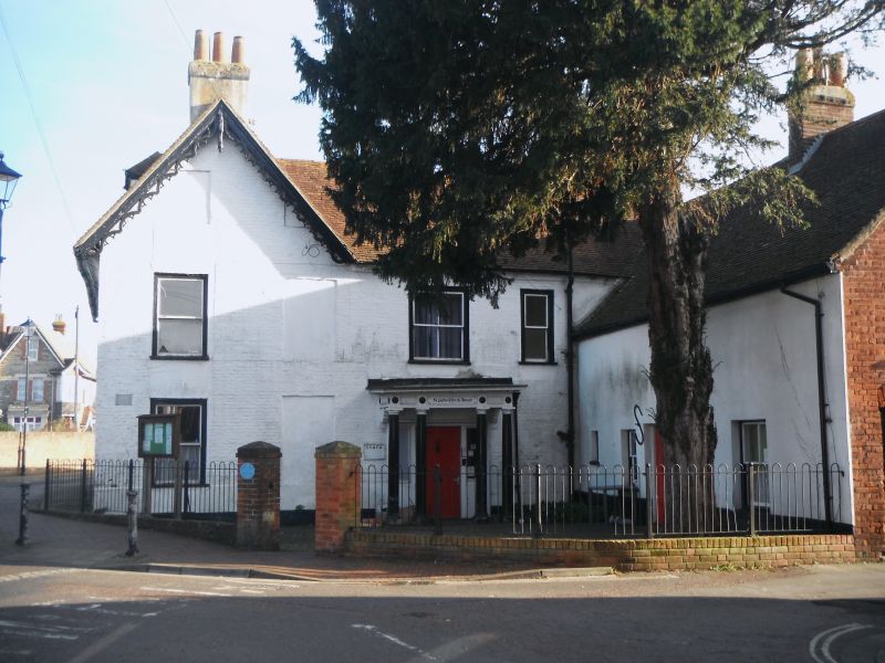
House (church office). C18, with early C19 alterations. Brick, with a tile roof. Symmetrical north side of 2 storeys and attic, 3 windows. Tile roof with coved plastered eaves, 3 hipped dormers with sashes. Painted brick walling in Flemish bond, rubbed flat arches, plastered 1st floor band and plinth. Victorian sashes. The west gable, with southward extensions, includes decorated cusped bargeboards and a porch of 4 columns, with cornice, panelled frieze, 6-flush-panelled door between side windows. The long east wing has a tile roof, brick dentil eaves, red brick walls in Flemish bond, rubbed flat arches, and Victorian sashes. The plain, brick and tile, stable block at the south-west corner, is used as a shop.
Listing NGR: SU7116098966
External links are from the relevant listing authority and, where applicable, Wikidata. Wikidata IDs may be related buildings as well as this specific building. If you want to add or update a link, you will need to do so by editing the Wikidata entry.


Other nearby listed buildings