Approximate Location Map
Large Map »
Latitude: 51.21 / 51°12'35"N
Longitude: -1.4792 / 1°28'44"W
OS Eastings: 436479
OS Northings: 145768
OS Grid: SU364457
Mapcode National: GBR 72R.4TN
Mapcode Global: VHC2S.9VWB
Plus Code: 9C3W6G5C+X8
Entry Name: 1, Marlborough Street
Listing Date: 24 June 1983
Grade: II
Source: Historic England
Source ID: 1093466
English Heritage Legacy ID: 139534
ID on this website: 101093466
Location: Andover, Test Valley, Hampshire, SP10
County: Hampshire
District: Test Valley
Civil Parish: Andover
Built-Up Area: Andover
Traditional County: Hampshire
Lieutenancy Area (Ceremonial County): Hampshire
Church of England Parish: Andover St Mary
Church of England Diocese: Winchester
Tagged with: Building
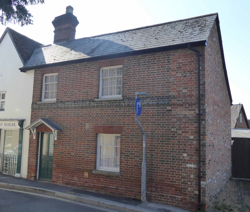
SU 3645 NW ANDOVER MARLBOROUGH STREET
4/76 No 1
II
Early C19. Two storeys, 2 windows. Slate roof. Red brick walling in Flemish bond,
first floor blue brick band, rubbed flat arches, plinth. Sashes in reveals.
Four-flush-panelled doors in a plain opening (the pediment load now missing).
Attached to No 2 Chanty Street.
Listing NGR: SU3648645838
External links are from the relevant listing authority and, where applicable, Wikidata. Wikidata IDs may be related buildings as well as this specific building. If you want to add or update a link, you will need to do so by editing the Wikidata entry.


Other nearby listed buildings
